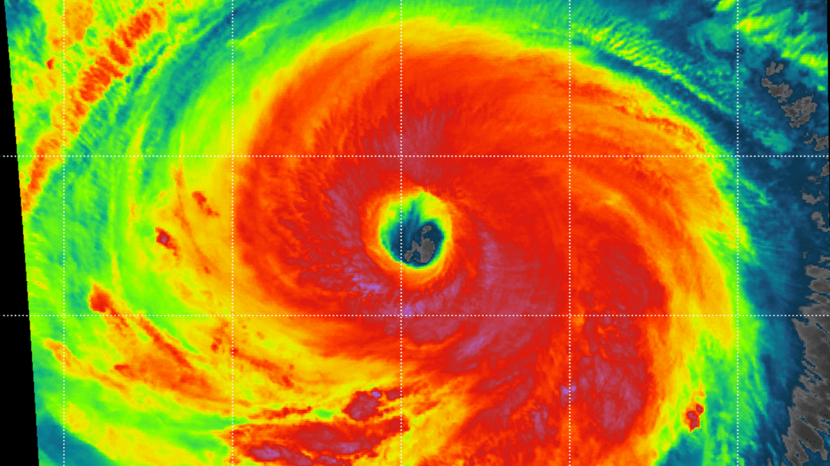

The Western Pacific has unleashed its latest atmospheric monster, a Super Typhoon Bavi. Bavi has exploded from a modest 60-mph tropical system into a colossal Category 5-equivalent monster in less than 48 hours, putting the entire region on high alert. With the peak intensity featuring 180-mph sustained winds and a central pressure of 901 mbar, Bavi has solidified its status as one of the most violent and rapidly intensifying storms of the season.
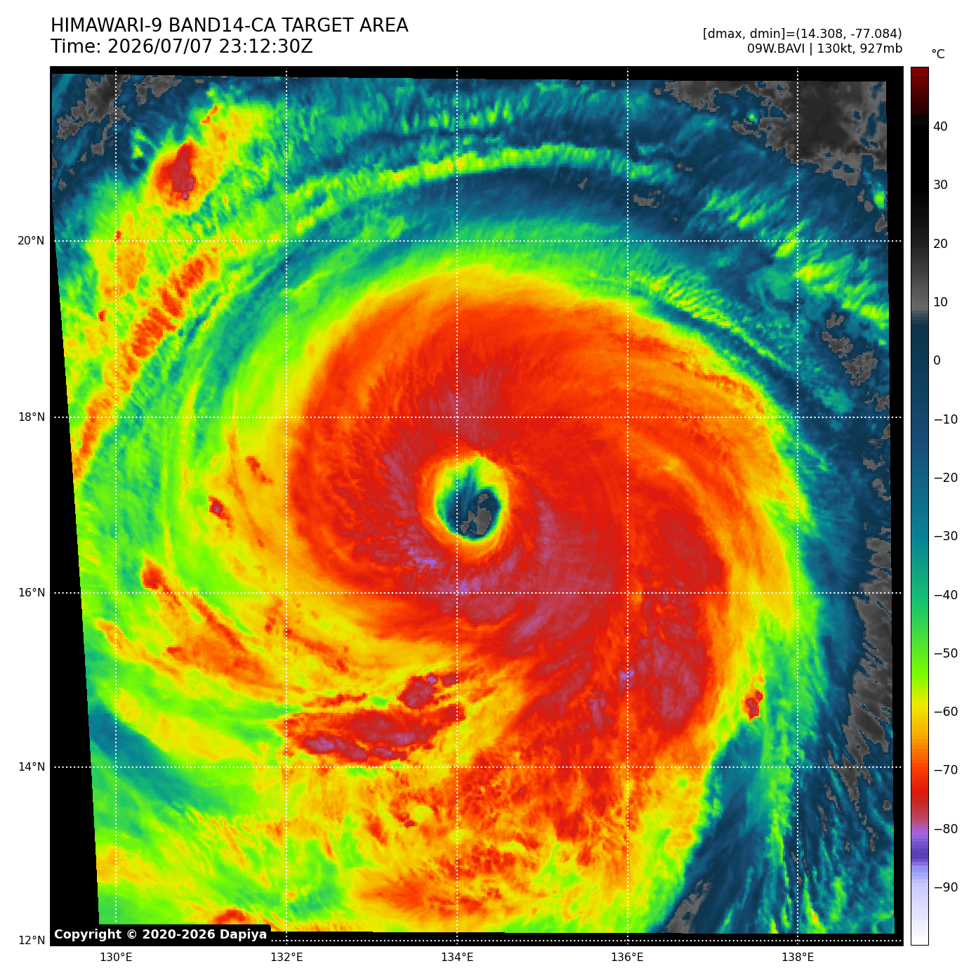
Exceptionally warm, deep oceanic water temperatures of 29–32 °C and nearly zero wind shear have led to near-perfect atmospheric outflow and upper-level ventilation. Its buzzsaw rotation underwent a classic eyewall replacement cycle, only to emerge larger, more structured, and even more dangerous with a much wider destructive wind field.
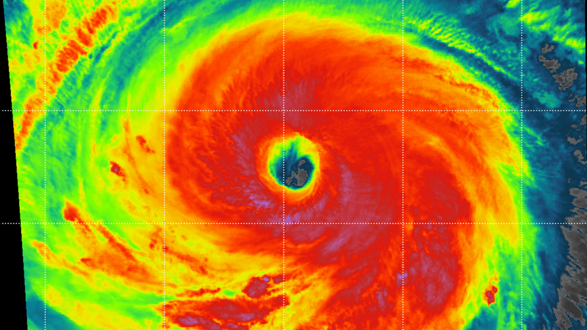
The true showcase of Typhoon Bavi’s rough power came when its northern eyewall slammed directly over the island of Rota in the Northern Mariana Islands, blasting the landscape with catastrophic, hurricane-force winds and torrential rain; the damage was significant. More than 20″ of rain was reported from Guam island as well, and winds gusted up to 85 mph.
Super Typhoon Bavi continues its relentless westward track toward the extremely warm Philippine Sea, and its next impact will be northern Taiwan on Friday. The latest Advanced Dvorak automatic satellite analysis suggests Typhoon Bavi maintains violent strength and a wide wind field.
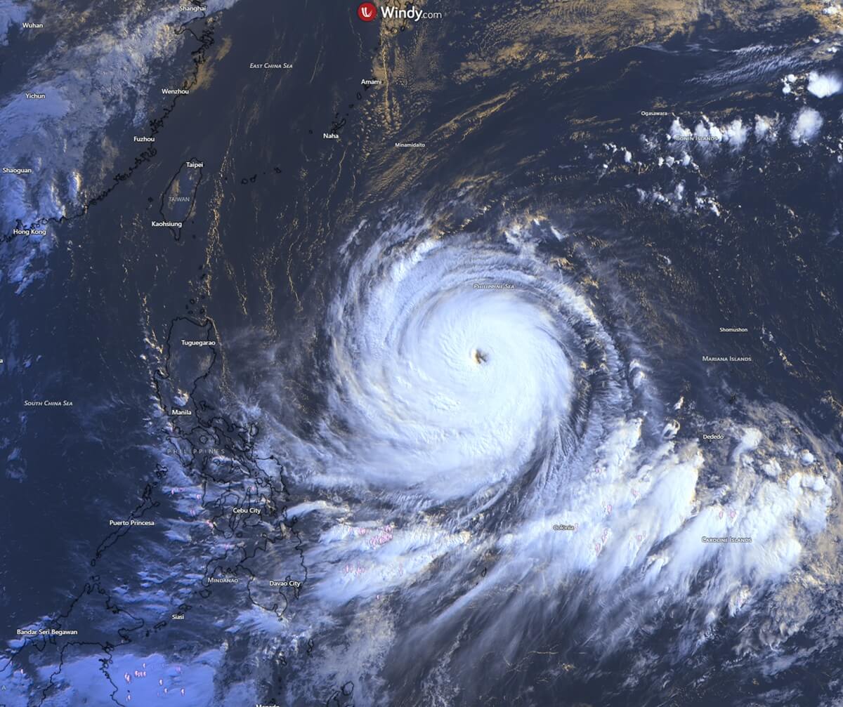
Guam lies in the so-called “Typhoon Alley” where intense tropical systems are tracked as they move across the Western Pacific. Several intense typhoons in recent years have hit the Marianas, including Karen, Paka, and Pongsona. Typhoon Karen changed everything; prior to 1962, most homes were wooden. Today, Guam is a ‘concrete island’ specifically because of these statistics.
To better understand Bavi’s strength compared to other tropical cyclones in the island’s history, these are the top 5 most notorious typhoons to hit Guam:
- Typhoon Karen (1962): The strongest storm ever hit Guam. Karen flattened the island with winds of 175 mph, destroying nearly 95% of its buildings and forcing a total overhaul of local building codes to reinforced concrete.
- Typhoon Pamela (1976): A slow-moving monster that raked Guam with sustained 140 mph winds for hours, bringing devastating rainfall and causing deep structural damage island-wide.
- Typhoon Omar (1992): The storm’s eye passed directly over Guam, catching residents off guard and leaving the island without power and water for weeks while causing over $450 million in damage.
- Super Typhoon Paka (1997): Paka blasted Guam with an astonishing 8 to 10 hours of intense typhoon winds. A peak gust of 236 mph was recorded at Andersen Air Force Base before the anemometer failed.
- Super Typhoon Pongsona (2002) / Typhoon Mawar (2023): Pongsona hit at peak intensity, leaving a $730 million damage trail and completely knocking out the island’s infrastructure. More recently, Typhoon Mawar caused massive infrastructure damage with its crushing 140-mph eyewall sweep.
The animation below indicates how Bavi behaved in the last two days.
The key message – current weather advisory:
- Storm classification: Super Typhoon
- Maximum sustained winds: 135 knots / 155 mph / 250 km/h
- Peak wind gusts: 165 knots / 190 mph / 305 km/h
- Central pressure: 920 mbar
- Primary threat: Philippine Sea, then Taiwan with extreme rainfall and hurricane-force winds, major flooding risk over the weekend
- Rainfall: 15–20 inches expected near the core, up to 40″ across Taiwan
Let’s examine the region’s current conditions, the forecast tracks, and the storm’s impact.
Above-normal seawater temperatures across the tropical western Pacific
Sea temperatures across the western tropical Pacific remain extremely high this month, ranging from 28 to 32 °C. These high water temperatures lead to higher dew points and elevated near-surface energy, so convective storms ingest this volatile air mass and support explosive thunderstorm activity.
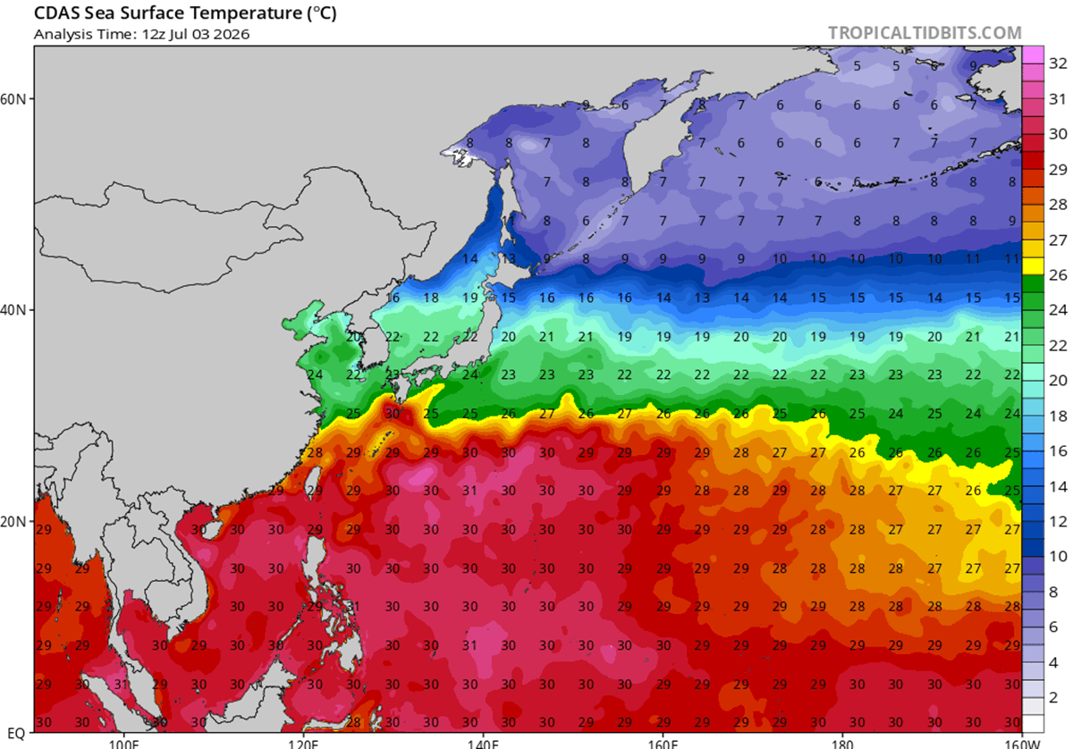
Sea surface temperatures are about 2-3 °C above average for early-mid July in the region, and they are even warmer farther west.
Notice that sea waters remain extremely anomalous along the coasts of China, Taiwan, and Japan, with temperatures exceeding the long-term average by 4 °C.
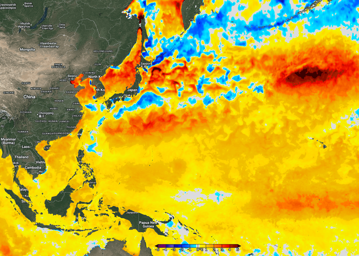
Any tropical system that enters such warm waters gains strength.
This is precisely what has happened with Super Typhoon Bavi over the weekend. Extremely high water temperatures led to its rapid intensification into a Category 5 monster storm in less than 48 hours before impacting the Northern Mariana Islands.
Super Typhoon Bavi becomes the world’s next Category 5 storm, on its way to Taiwan on Friday
The automatic satellite analysis of Super Typhoon Bavi indicates that the estimated peak winds are now near 135 knots, consistent with a Dvorak intensity of 6.8. The central pressure is estimated to be around 916 mbar.
The most intense winds extend 60-70 miles from the core in all quadrants, indicating a symmetrical, expanding wind field. Tropical-storm-force winds extend up to 110 miles from the large eye.
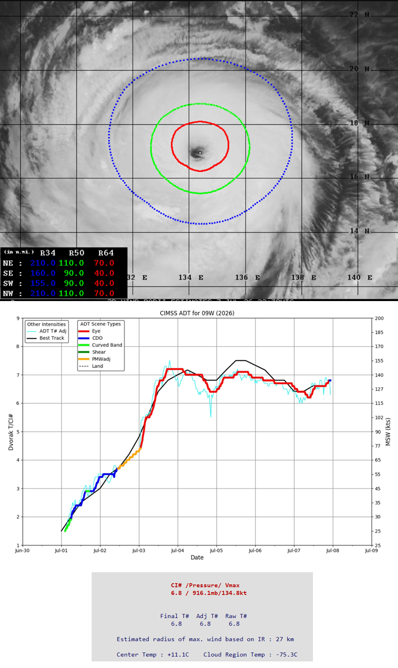
The infrared satellite shows how impressively large Bavi already is.
Through Friday, Bavi will continue tracking west-northwest while slightly restrengthening and maintaining its Category 4 to 5 strength.
The most likely scenario involves Typhoon Bavi moving towards Japan’s southern islands archipelago and impacting northern Taiwan with its intense, wide wind field. The impact will likely be with the high-end Category 4 strength. Violent, destructive winds, catastrophic storm surges, giant waves, and flooding rain will blast the islands. The damage will be extreme.
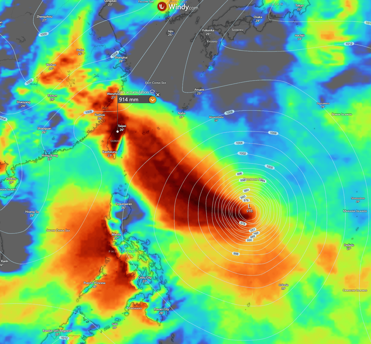
According to the weather models, the worst winds will likely miss Taiwan, but the rainfall will be exceptional, with up to 600-1000 mm of accumulated rain within two days. Bavi will then continue until China’s coast by Saturday local time.
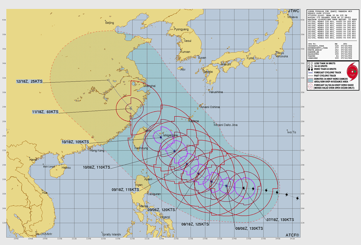
Bavi will then continue until China’s coast by Saturday local time.
Bavi is set to deliver a destructive impact to northern Taiwan and southern Japan islands
The swath of violent winds will be large as Bavi continues west-northwest over the next three days. While it may reach Category 5 strength again before Friday, it will then begin a gradual weakening phase while remaining an extremely dangerous storm.
Winds will be violent across a broad area around the center.
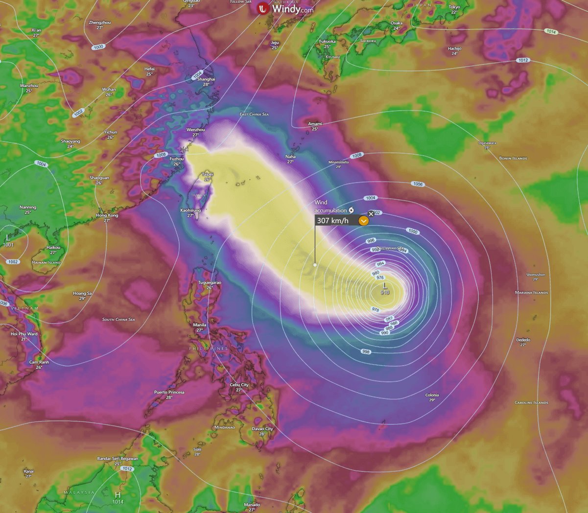
The central pressure should remain between 900 and 930 mbar for another 36 hours; it could drop even further if intensity changes significantly, e.g., the inner core tightens again. The pressure will, however, remain extremely low also when Bavi passes over Japan’s islands and nears northern Taiwan.
Normally, eyewall replacement cycles (ERCs) occur with these cyclone sizes and intensities. When they occur, fluctuations in intensity follow, so the future intensity strongly depends on those.
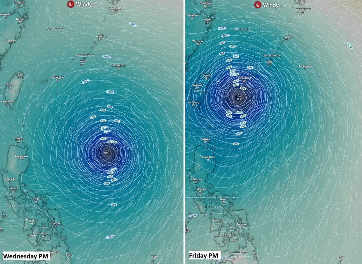
Low pressure and a tight pressure gradient support destructive winds, which will gust well above 250 km/h. Based on the latest weather model guidance, the intensity is expected to remain at a strong Category 4 or return to Category 5 status until Friday.
Then, a gradual weakening occurs as Bavi enters cooler waters and encounters stronger shear near the China coast and the mainland.
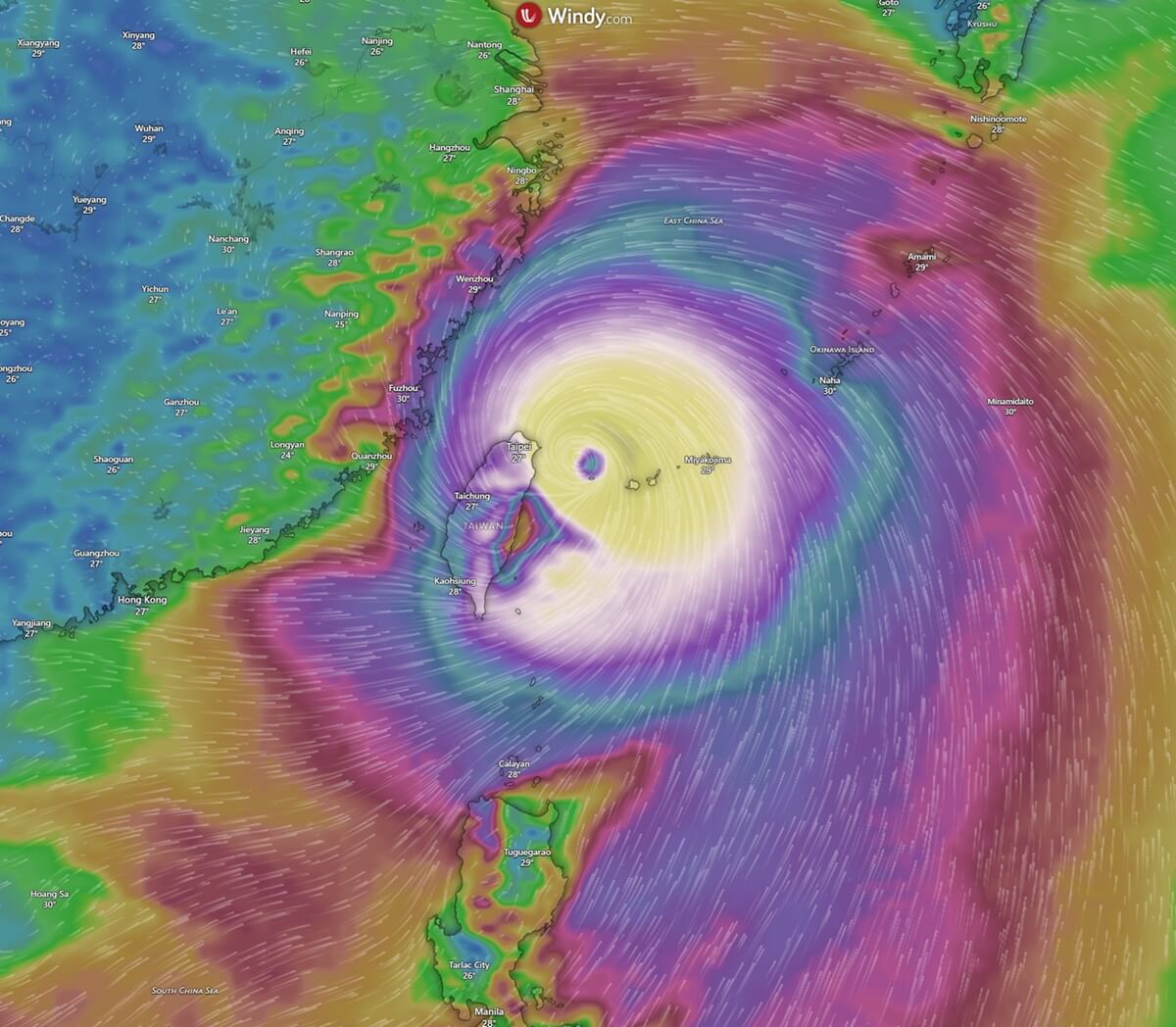
Usually, the most robust thunderstorms with intense rainfall and downpours surround the eye, following the most extreme activity in the eyewall.
This is also where the most significant rainfall is expected. Most weather models predict that 300-500 mm of rain will likely fall along its path over the open waters of the Philippine Sea. High rainfall amounts will also occur over the southern Japanese islands on Friday, Ishigaki and Miyakojima.
Extreme rainfall will fall over Taiwan’s mountainous terrain, potentially reaching up to 1000 mm (40 inches) within two days. Destructive flash floods will occur.
After Friday’s impact, Bavi will begin to weaken as it tracks towards the China coast, but will remain a powerful storm with severe winds, more flooding, and storm surge expected.
Windy, CyclonicWX, and Tropical Tidbits provided images used in this article.
See also:
A Cold Atlantic Anomaly Returns as Super El Niño Shapes Winter 2026/2027 Early Forecast Signals