Followed by the persistent blocking High over the North Atlantic, another cold wave will travel south across central Europe, reaching the deep south Mediterranean and intensifying over North Africa mid this week.
This is the final ‘kick’ of the Polar Vortex collapse earlier this month as its southern lobe shifted towards Europe.
This deep atmospheric wave is carving a path toward the warmer waters of the Ionian and Aegean Seas, transporting an unseasonably cold, polar-origin air mass into the heart of the Mediterranean basin.
By Wednesday, the trough detaches from the main flow and becomes a cut-off low, providing the vertical lifting mechanism necessary to trigger rapid and violent secondary cyclogenesis at the surface, travelling over Greece and the Aegean Sea.
The low-pressure system stalls over the southern Mediterranean, creating a sharp thermal contrast between the colder upper atmosphere and the relatively warm sea surface, which will fuel atmospheric instability. The so-called “baroclinic instability” acts as an engine of the system, causing surface pressures to fall and thereby create an organized, compact cyclone.
By Wednesday morning, the strong gradient between this deepening low and the high pressure over the Balkans will begin to compress, supporting a potentially dangerous wind event across the Greek archipelago.
Greece and the Aegean Sea will be the most impacted underneath a broad warm sector, supporting both torrential, convective rainfall capable of triggering flash floods in mountainous terrain and severe thunderstorms. A potential also exists for severe thunderstorm training, leading to extreme rainfall accumulations within hours.
Over the Aegean Sea, a strong pressure gradient will develop powerful low-level winds that will generate significant wave heights reaching up to 7 meters.
The main impacts:
- Torrential rain and thunderstorms: Long-lasting and intense rainfall with severe thunderstorms
- Flood risk: Increased likelihood of severe flooding, especially in urban areas and regions with complex, mountainous terrain
- Dangerous winds and High waves: Gale-force winds reaching locally 9 to 10 Beaufort, causing problems in sea transport, generating significant wave heights up to 7 meters
Let’s dig into pattern development and the potential impacts through midweek.
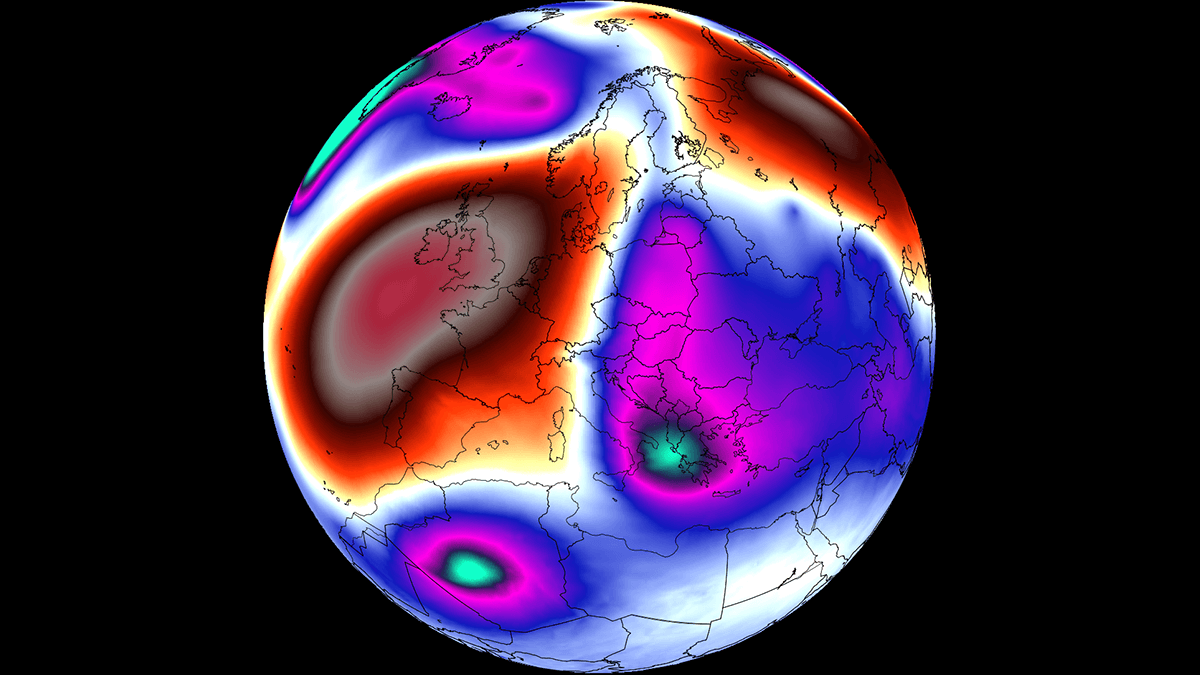
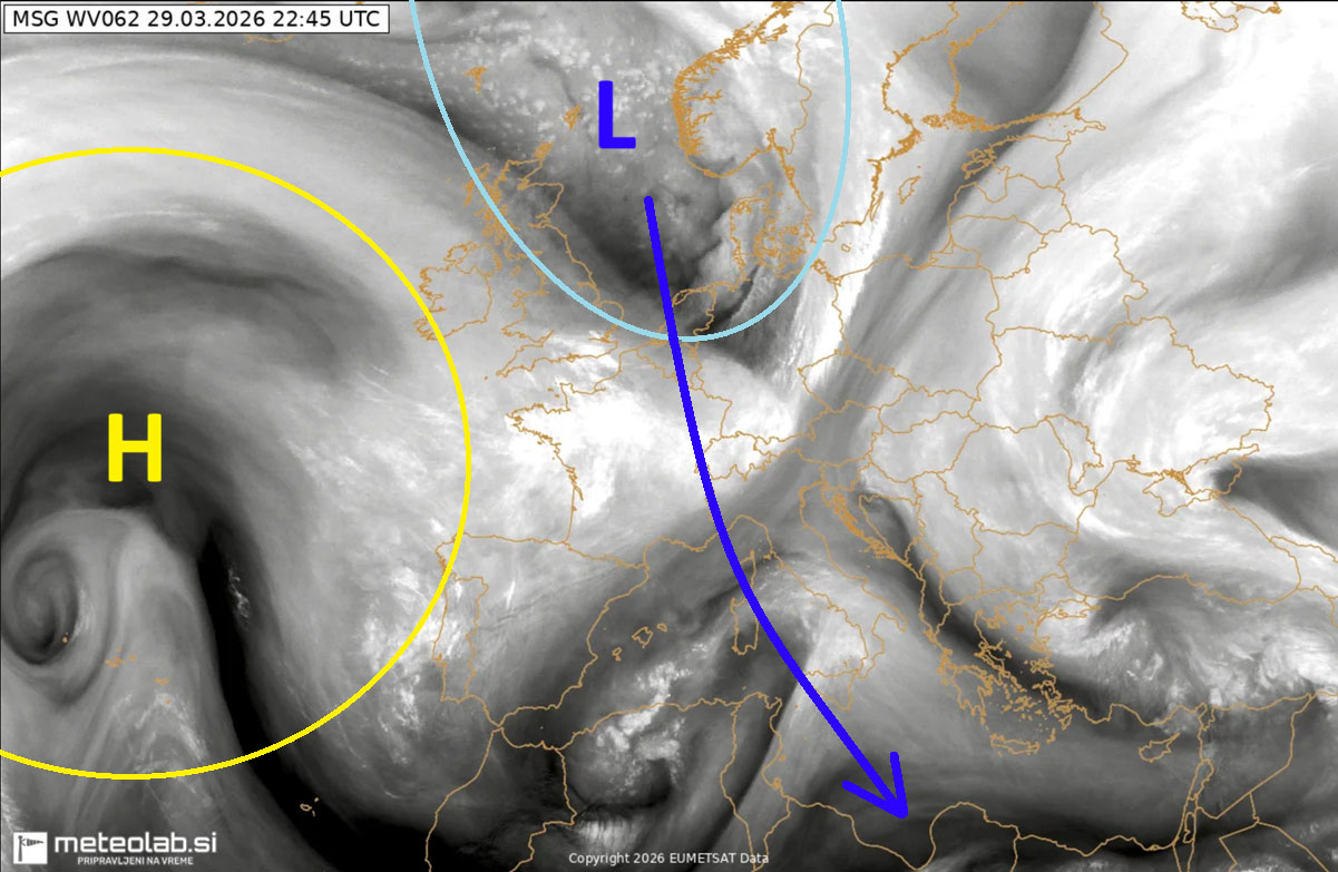
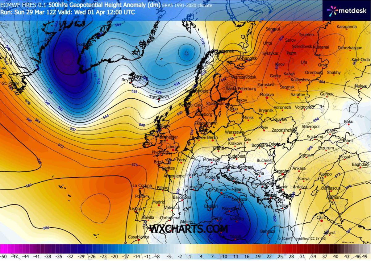
The North Atlantic is blocked, sending another deep Polar cold wave across Europe
A massive, intense upper ridge of high pressure remains over the North Atlantic and Western Europe. On its eastern flank, a deep trough is digging southward across Scandinavia and Central Europe toward the Mediterranean.
The strong contrast between the blocking west and the lower geopotential heights to the east results in a powerful jet stream in between, delivering a much colder air mass deep far south once again. As the cold upper wave arrives in the southern Mediterranean, it amplifies the subtropical jet stream.
This supports a rapid development of surface cyclogenesis over the region.
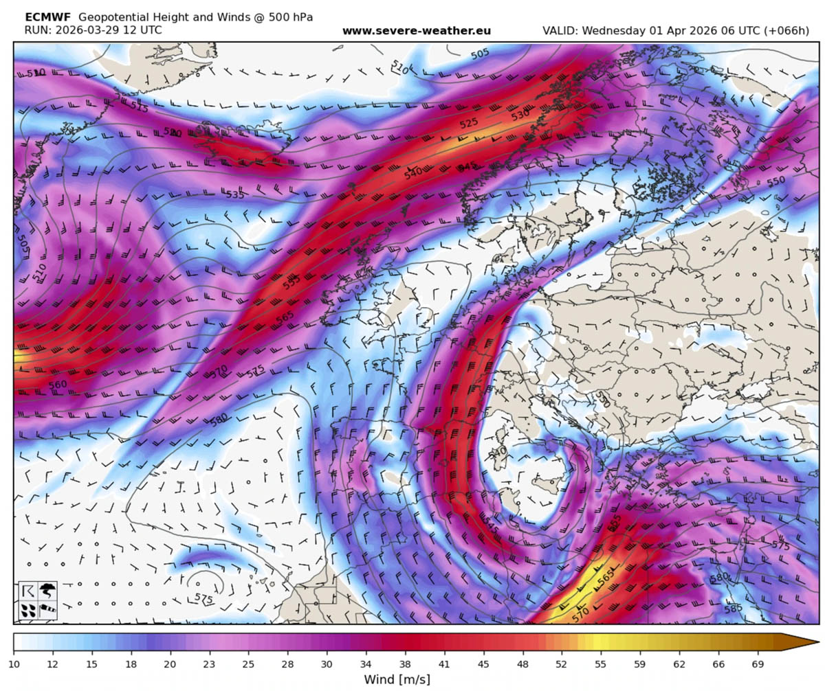
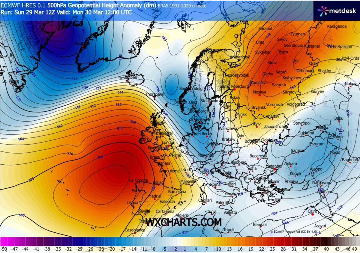
The upper wave cuts off over the southern Mediterranean and North Africa on Wednesday and further intensifies. Sending significantly and unseasonably cold temperatures across the broad region.
While the temperatures improve over northern, eastern, and western Europe, the temperature anomalies over the Mediterranean, including Algeria, Tunisia, and Libya, will be staggeringly low.
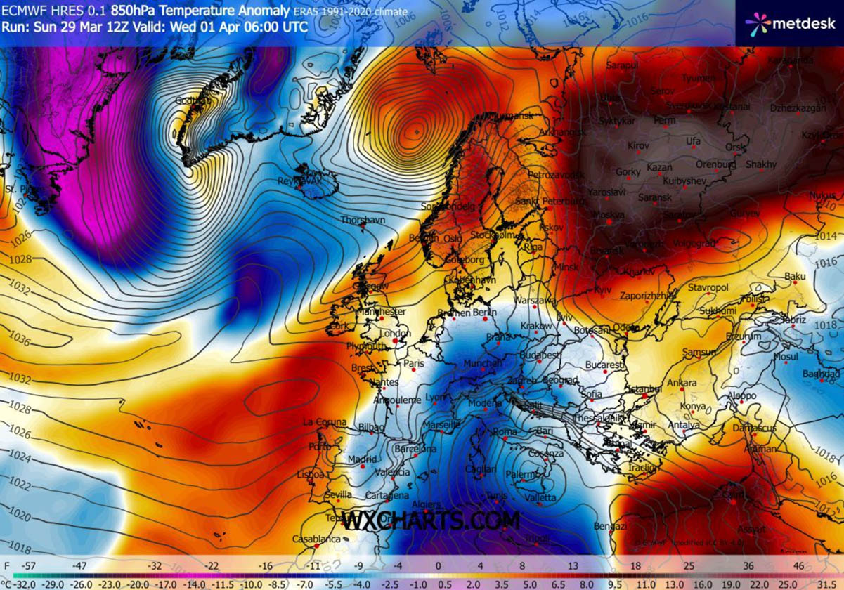
Temperatures will be around 15 °C below normal for early April.
Greece and the Aegean are under siege on Wednesday, with severe thunderstorms and potential for flooding
As the upper low stalls over the region, it results in a high temperature and pressure gradient, supporting rapid secondary surface low formation over Greece and the Aegean Sea.
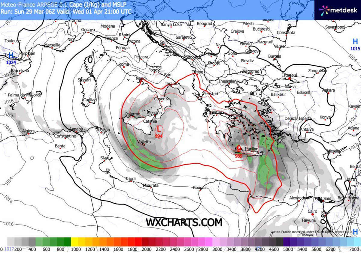
The low will grow quite large on Wednesday, with the central pressure plummeting into the upper 980s as the weather system matures. The large, low-lying core covers a broad area from the Ionian to the Aegean Seas.
With the high-over-low pattern, the high-pressure system over western and central Europe creates a strong pressure gradient across parts of Italy and the western Balkans, resulting in severe downslope Bora winds along the Adriatic Sea.
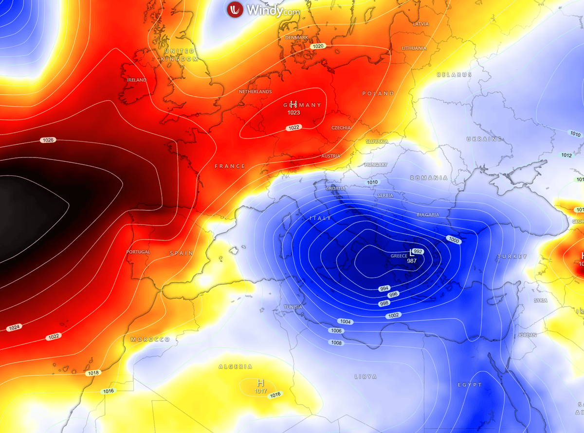
The primary surface low takes place over southern Italy, Malta, and the Ionian Sea on Tuesday night, while the upper wave aloft makes another turn, digging further south into North Africa.
This triggers a strong divergent flow from the amplified subtropical jet stream, resulting in a rapid secondary surface low that travels towards Greece and the Aegean Sea. Heavy precipitation, including thunderstorms blast into Greece.
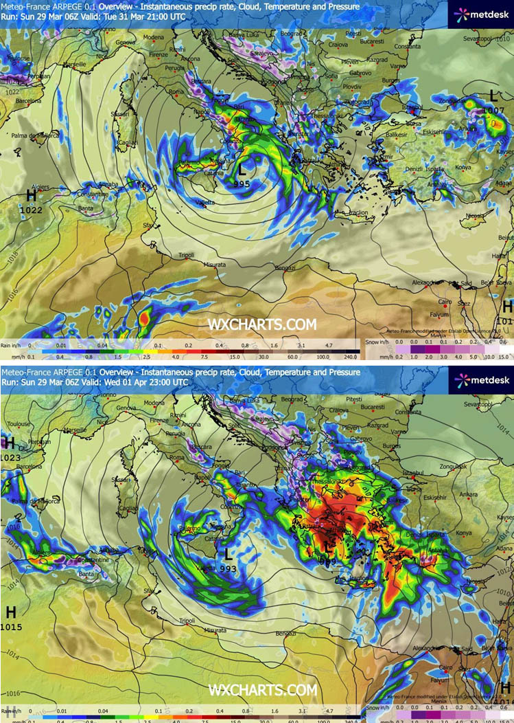
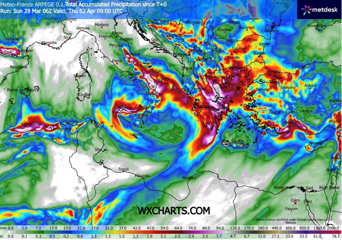
It results in heavy, torrential rainfall, with high rain accumulation especially over south and central Greece. Rainfall sums will locally exceed 100 mm in 24 hours, causing risk of river flooding and urban flash floods.
Notice also that another rainfall maximum is likely over the island of Sicily, Italy, due to the northerly flow in the wake of the primary surface low. High precipitation sums are also expected across the southern Apennines with the northeast flow from the south Adriatic to southern Italy.
A greater concern is the Aegean Sea archipelago, situated beneath the broad warm sector and an increasingly unstable air mass. CAPE energy will be moderate, with up to 800-1000 J/kg from Wednesday afternoon into evening hours.
This is more than enough for organized, strong convection, fueled by the warm seas and the high moisture influx from the southern Mediterranean.
The amplified jet stream winds aloft will support an intense wind shear, overspreading the warm sector from northern Libya to the Aegean Sea and western Turkey.
Thus, supporting severe thunderstorms with strong to severe winds, torrential rainfall, and tornadoes.
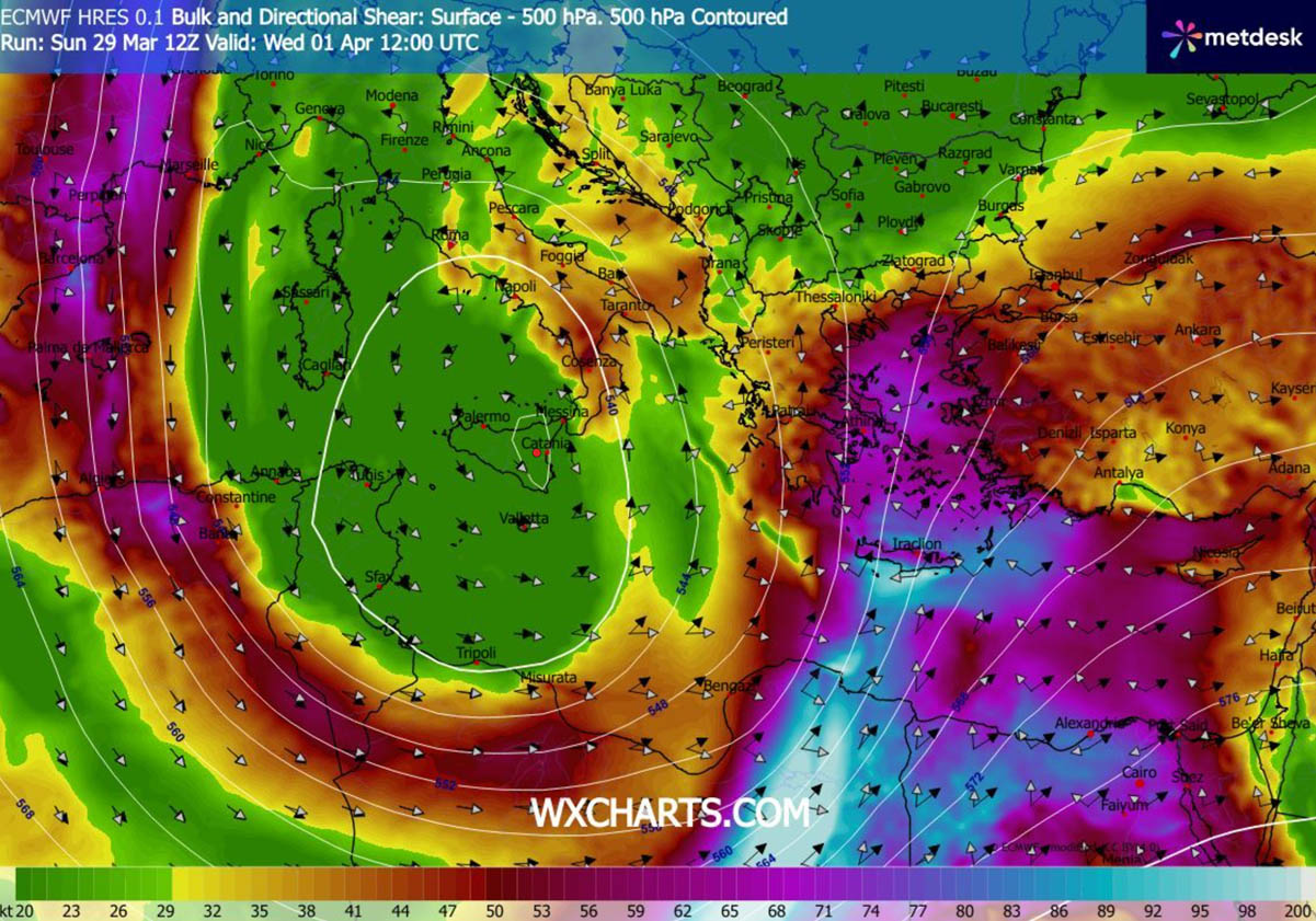
The tornado potential seems the most prominent where the low-level winds will be maximized over the Aegean Sea. This will introduce very 0-1 km and 0-3 km shear and helicity, supporting rotating storms.
A few intense tornadic supercells are not ruled out for the region in the evening hours before storms cluster and clash into the western Turkey complex terrain. The best conditions seem to develop in the area between Crete, Rhodes, and Izmir, Turkey.
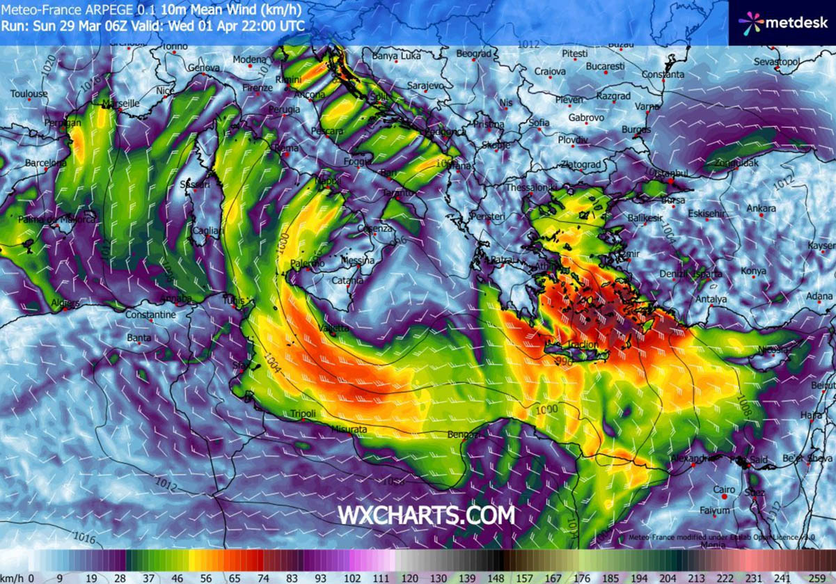
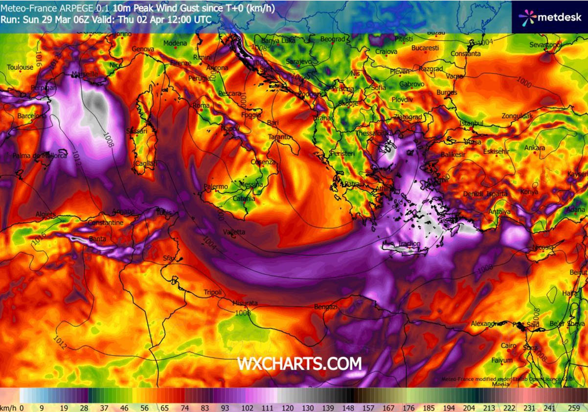
Overall, the strong pressure gradient and an amplified jet stream aloft will create very windy conditions on Wednesday, as seen on the following chart. The swath of strong-to-severe winds will round the base of the broad surface low.
Emerging from the southern Tyrrhenian Sea across Malta and the southern Mediterranean into southern Greece and the Aegean Sea in particular. High wind gusts up to 120 km/h will be possible, with significant wave heights across the archipelago, with the highest waves expected for eastern Crete and the southern and eastern islands of Rhodes.
Stay alert for dangerous weather conditions as an unseasonably deep upper wave digs into the southern Mediterranean on Wednesday. A potent, rapidly developing surface low should trigger severe thunderstorms and flooding across the Greek mainland and the Aegean Sea archipelago.
Windy, and Wxcharts provided images used in this article.
See also: