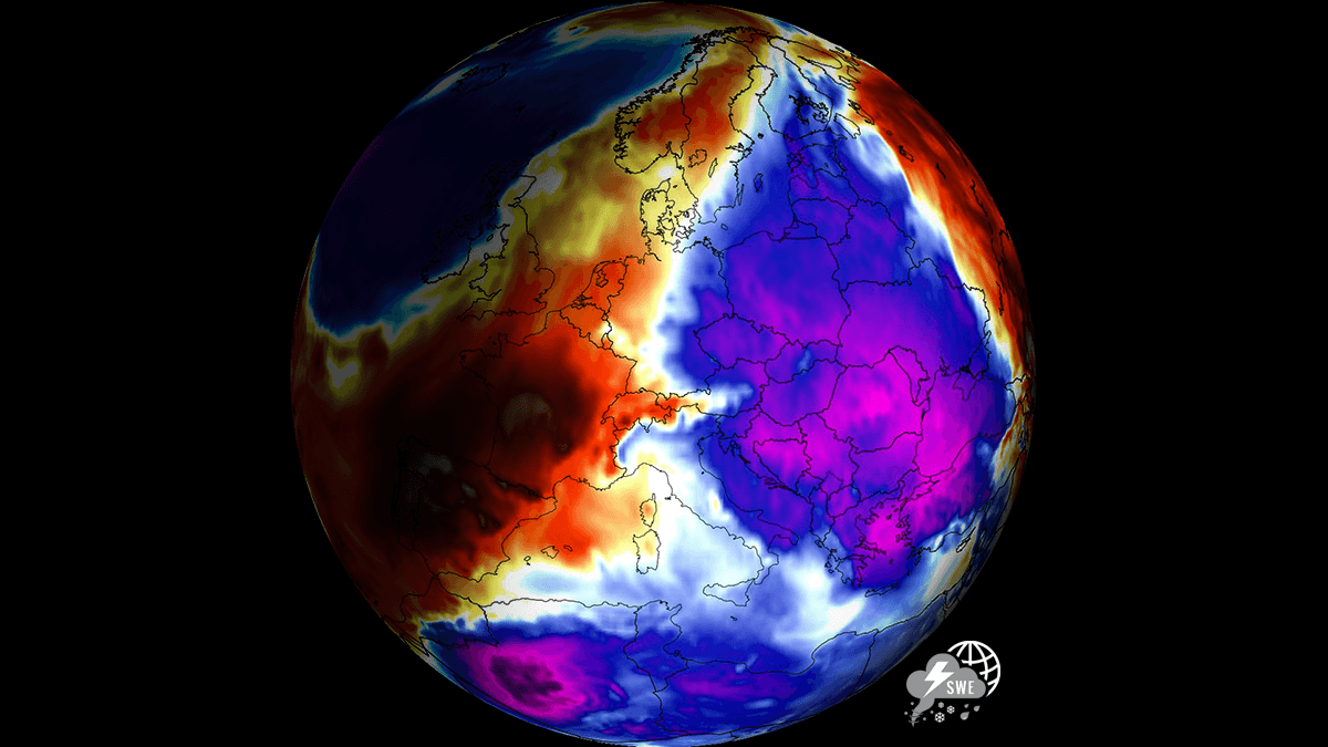

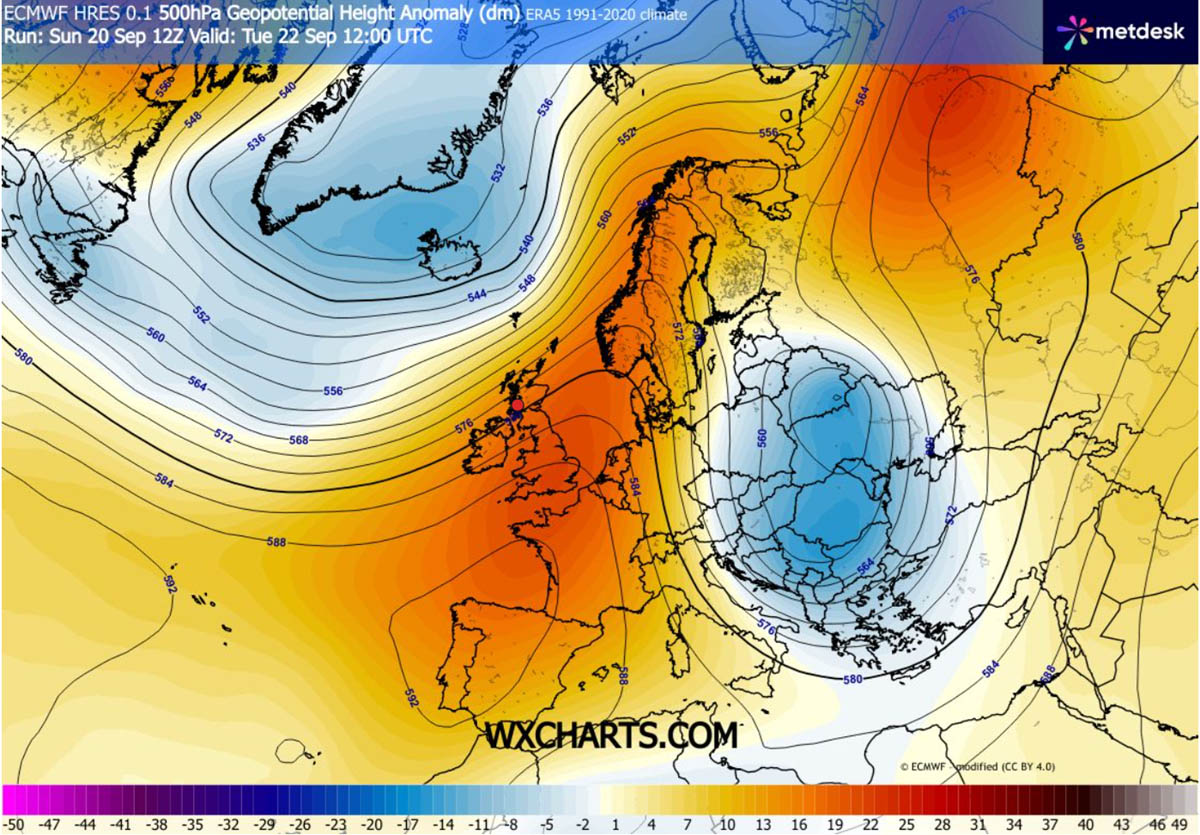
The main driver of this rapid thermal drop this week is a massive upper-level blocking ridge building over the North Atlantic and Scandinavia. This high-pressure area is forcing a direct atmospheric corridor for meridional flow from the north, allowing dense, polar-origin air to spill deep across Eastern Europe.
As the cold front pushes south, daytime high temperatures across impacted regions will plunge by 10 to 15 °C compared to recent seasonal averages.
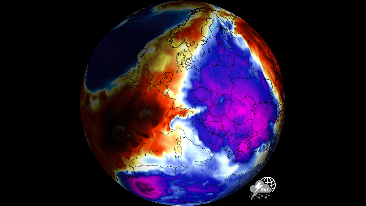
As the polar air mass settles over the region, clear nocturnal skies and lighter winds will support first morning frost across low-lying valleys and agricultural basins from the Baltic countries down to the central Balkans, reaching Romania and Bulgaria. Across the higher elevations of the Carpathians and possibly the Northern Balkans, falling freezing levels will trigger the first notable high-altitude snowfalls of the autumn season.
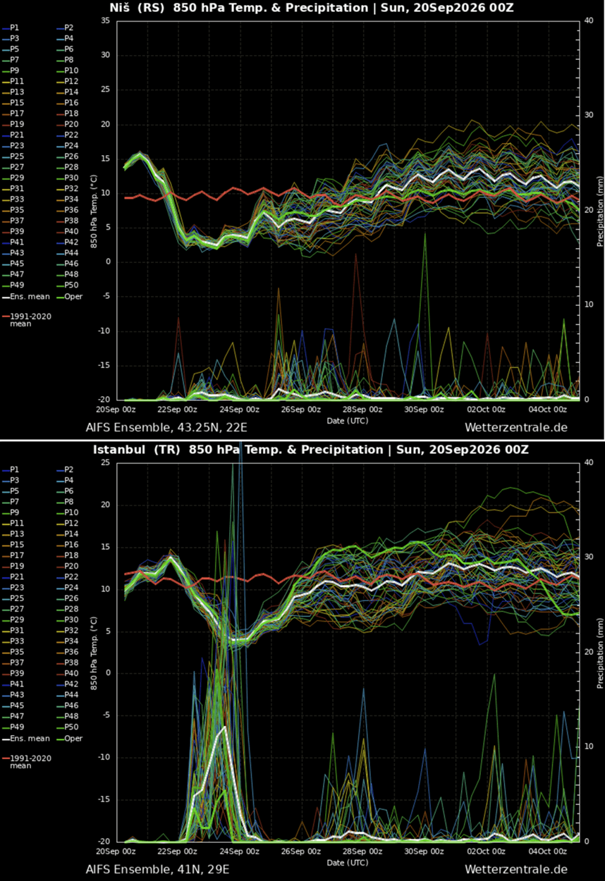
While the cold intrusion will last only through the mid-week days, it will be significant for the second half of September. The meteogram charts for Niš, Serbia (upper) and Istanbul, Turkey (bottom) both show a sharp temperature drop on Tuesday and Wednesday.
The following forecast model animations and 850 hPa temperature anomaly maps below illustrate the progression of this Arctic air mass across the eastern half of the continent, highlighting where the most severe thermal anomalies and early-season freeze risks will focus over the coming days.
Let’s dig into the details of this significant pattern change that is temporarily ending the return of warmth over Eastern Europe this week.
Synoptic Setup: North Atlantic Ridge Drives Arctic Air Plunge into Eastern Europe
The general weather picture over the North Atlantic and European continent this week shows a strong upper-level ridge over Western and Southwestern Europe, expanding toward Northern Europe as a Scandinavian High develops. A large upper-level wave is emerging into Eastern Europe on Tuesday. It is spreading south through midweek, reaching as far south as the southern Balkans and Turkey.
The general winds between the western ridge and eastern low establish a meridional flow pattern, delivering a cold air mass across most of Eastern Europe and the Balkan Peninsula.
At the surface, the high-pressure area linked to the strong blocking high over the west will rapidly expand into Scandinavia and Central Europe as cold waves emerge across Eastern Europe.
This will allow meridional flow to spread across Eastern Europe, including eastern portions of Central Europe and the whole Balkan Peninsula.
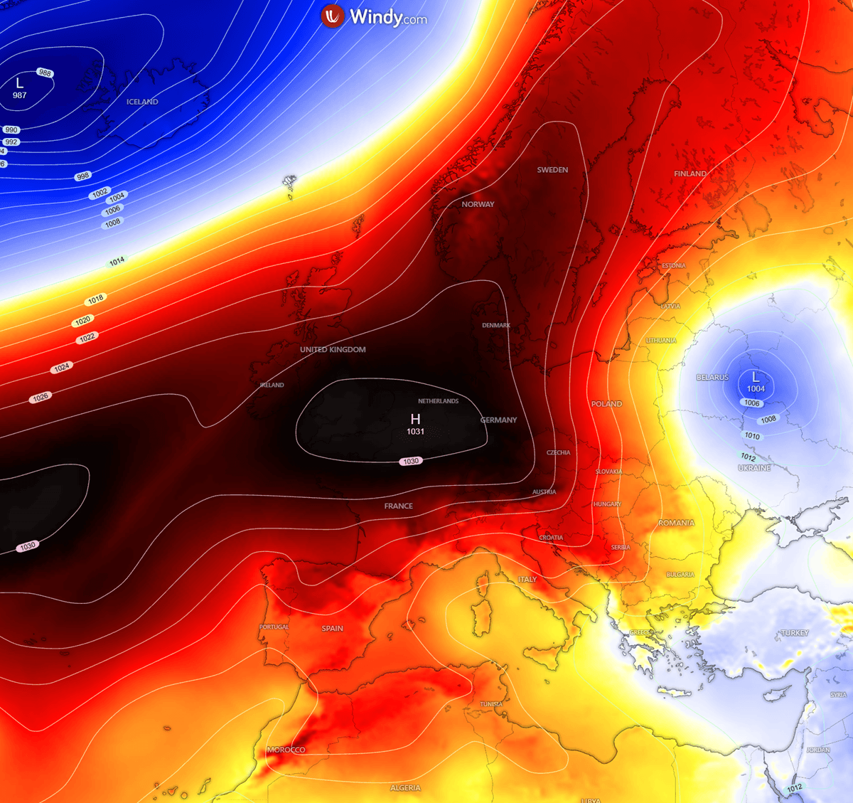
On Tuesday, a widespread cold air mass spread across the Balkan Peninsula, reaching Greece and the Aegean Sea on Wednesday before it spread into the Black Sea region and the rest of Turkey on Wednesday and Thursday.
Temperatures in the lowest and mid-levels will be about 6-10 °C below normal for late September, which is pretty significant after the recent persistent warm periods. Europe will be split in two halves, as a ridge with higher-than-normal temperatures remains in the west.
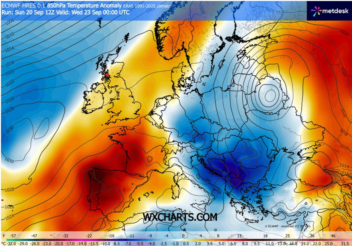
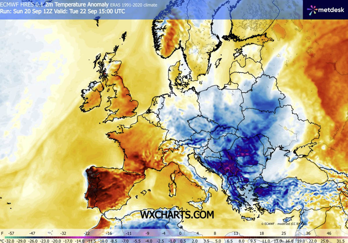
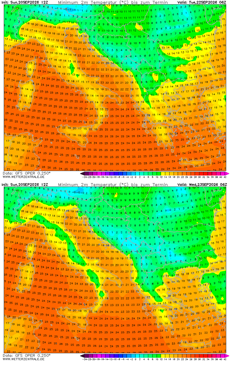
Surface temperatures across the Balkans will be lowest on Tuesday, reaching 10-15 °C below long-term averages across Serbia, Bosnia, Romania and Bulgaria. Cold will also be significant for Greece and northwestern Turkey on Tuesday.
The dense Arctic air mass will continue further south and east towards Wednesday.
On Wednesday, the temperatures will be the most anomalous for Bulgaria, Greece and especially Turkey, with 12-16 °C colder than normal across Western Turkey.
With the core of the upper-level cold wave moving into the southern Balkans midweek, temperatures in its wake will gradually improve, with the ridge from Western Europe beginning to expand into Central Europe again late this week.
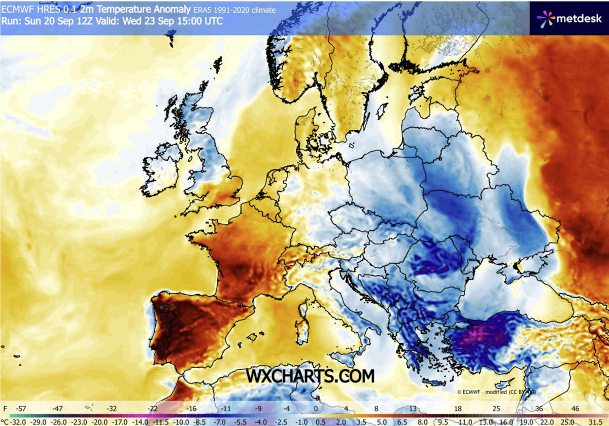
This week will bring dynamic but rapid displacement of warm continental air away from Eastern and partly Central Europe, thanks to the Arctic intrusion. The sharp temperature drop will follow behind the polar front after Tuesday.
Thermal Flip: Warmth Replaced by First Valley Frosts this week
Nighttime lows will plummet as the air mass clears behind the polar cold front, pushing Tuesday and Wednesday mornings into the low single digits. This could locally deliver freezing levels and the first frosts of the autumn season 2026.
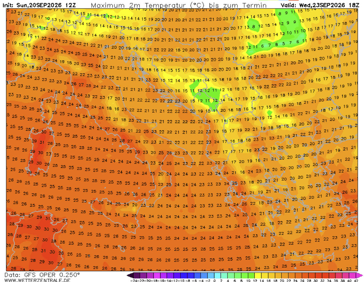
It will also cool during the day. First, cold winds will bring a cold Tuesday, followed by a cold Wednesday as the core of the polar low remains over the south-central Balkans and Western Turkey.
Temperatures will remain in the upper 10s to low 20s across the south-central Balkans, well below normal for this time of year. The touristic season is still in full swing in Greece and Turkey.
We will continue to monitor the weather pattern and update the forecasts accordingly. Long-term trends suggest the European pattern will remain as a dipole until late this week, then the upper-level ridge will expand into Central and Eastern Europe as the end of September nears. Stay tuned for updates.
WetterZentrale and WXcharts provided images used in this article.
See also:
A New Polar Vortex Is Emerging Over the North Pole, With a Winter 2026/2027 Disruption Risk