
While the meteorological summer has barely officially begun, the summer solstice is coming up this weekend. And it arrives in style, with a new massive, high-pressure Heat Dome settled over the continent. It will trap a stagnant layer of scorching-hot Saharan air and trigger an early-season heatwave of above-normal intensity from the Iberian Peninsula to the capitals of Western Europe.

The soil in many regions remains exceptionally dry from a record-breaking hot spell Europe experienced in late May, which strips away the Earth’s natural ability to cool itself through evaporation. This will allow surface temperatures to skyrocket even faster through the remainder of June.
The temperature forecast numbers are flashing red, with Portugal and Spain bracing for temperatures that could reach 45 °C (113 °F), while cities like Paris are facing extended, multi-day stretches in the upper 30s to low 40s, roughly 10 to 15 °C above seasonal averages.
It will become extremely hot in France and parts of Western and Central Europe as the Heat Dome strengthens and expands northward and eastward over the weekend and into the following week.
The driving force behind this pattern is similar to the one in May, a strengthening upper-level ridge building out of Northwest Africa and expanding across western and central Europe. The following animation delivers a quick overview.
Before we dig into the details about the pattern evolution in Europe, lets examine what is the main driver behind these extensive warm waves and heatwaves in general.
What is a Heat Dome?
When significant, record-breaking heatwaves occurred in Europe, the United States, and Canada in the past, the Heat Dome was a contributing factor. The heat dome is usually the dominant feature of summer weather patterns on both continents.
We refer to this phenomenon as a heat dome when extremely high temperatures develop. Here’s how it works and why understanding it on a broader scale is essential.
The upper-level ridge pattern, or very warm air mass in the higher altitudes, also known as the Upper High (or blocking High), usually forms the heat dome. This weather pattern brings high, and sometimes record-breaking, temperatures to the region below.
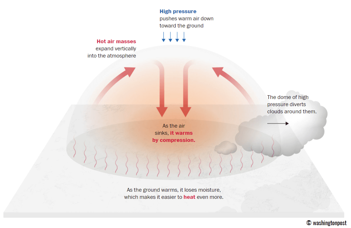
This term is used when a broad area of high-pressure air parks over a large portion of the continent. If the event is remarkably stable and extreme, it usually lasts several days or weeks.
The heat dome works like a lid on a pot. The extensive dome traps warm air at all levels underneath, with layers sinking toward the ground. Therefore, the air mass becomes anomalously warm at the lowest elevations and extremely hot near the surface.
How does a heat dome impact the life underneath?
Excessive heat in heat domes can significantly impact human health and be dangerous to particularly vulnerable populations, such as elderly individuals, children, and those with pre-existing health conditions that can be worsened by extreme heat.
Due to prolonged exposure to high temperatures, construction workers, farmers, and other long-hour outdoor workers are at increased risk of heat-related illnesses. People living in poverty are also more susceptible to the fatalities of heat domes, as their houses are often built with heat-trapping surfaces such as concrete and asbestos.
Heat exhaustion occurs with prolonged exposure to high temperatures. It leads to dehydration, dizziness, and, in more severe cases, heat exhaustion can progress to heat stroke.
High relative humidity during a heatwave can also significantly affect the body. For this reason, we use the Heat Index to represent the perceived feel of scorching-hot temperatures and high humidity. It illustrates the natural relationship between temperature and humidity.
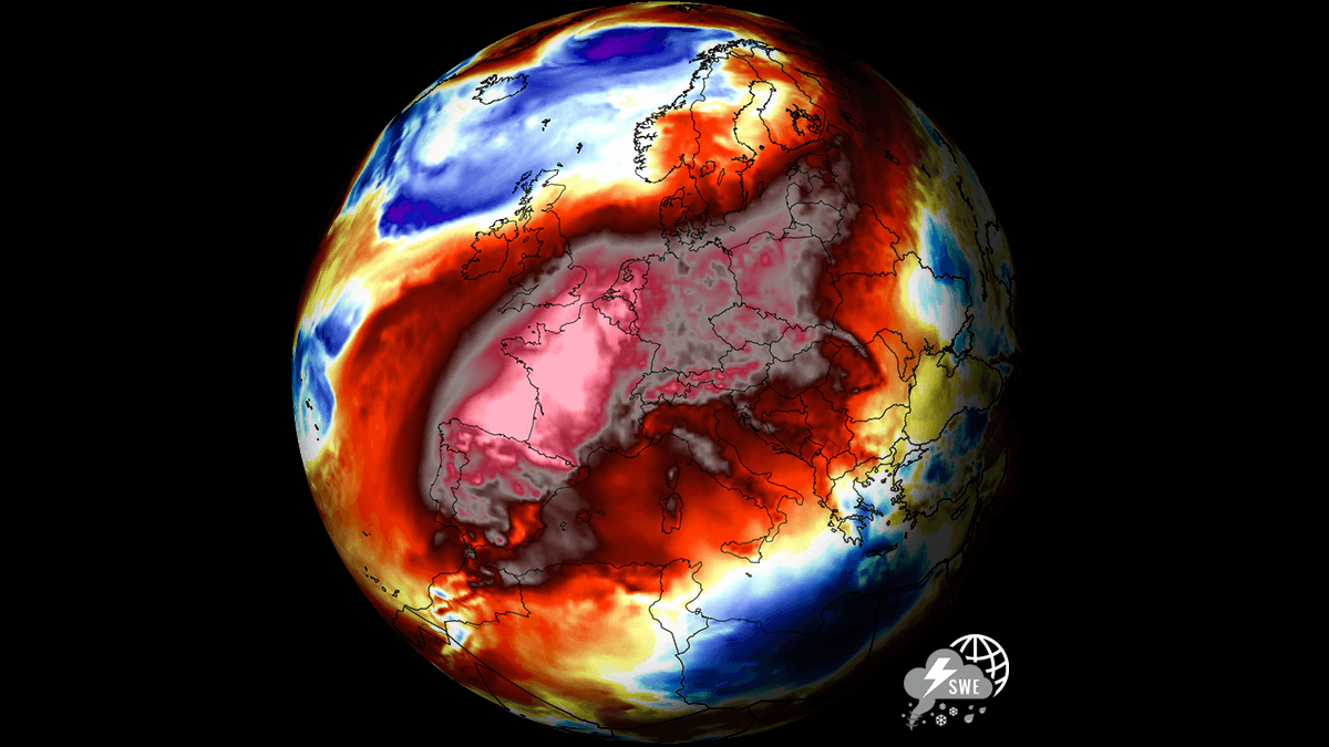
A new massive Heat Dome develops across (Western) Europe
The weather pattern over the North Atlantic and Europe is again taking shape, as a powerful blocking High builds over the continent for the weekend, followed by a significant warm plume expanding northeastward from northwest Africa into southwestern and western Europe first.
The extensive upper-level ridge will gradually expand further north and east, dominating most of the European continent throughout the remainder of June.
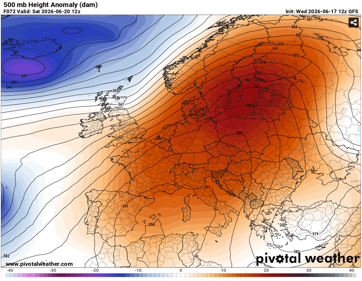
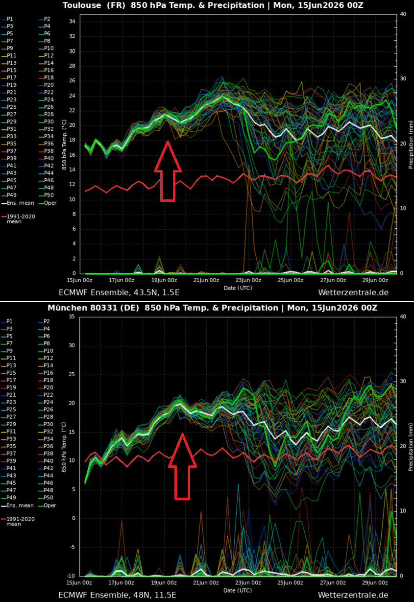
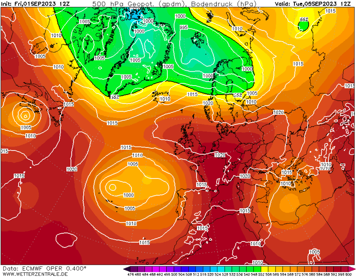
The medium-range ensemble guidance (ECMWF and GFS) indicates that the 500 mbar geopotential heights will reach near-record levels by the end of June, climbing exceptionally high as the upper-level subtropical air mass expands.
These anomalous upper-level heights at 500 mbar represent a highly anomalous late-spring tropospheric setup. With sinking air (compression and warming at the surface), surface temperatures will exceed the 40 °C threshold from the weekend through the early days of next week.
![]()
![]()
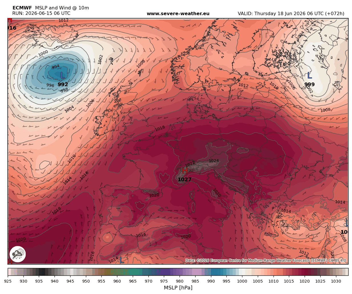
The sinking air within the heat dome also translates into rising pressure beneath it, thereby developing a surface high-pressure system centered over the heart of Europe, with higher-than-usual pressure across Western and Central Europe over the weekend and continuing into next week. No significant disturbances are foreseen, so the heatwave will be long-lasting.
As the upper ridge expands over time, the surface high-pressure area will expand as well. It will bring well-above normal surface pressure for most of the continent, except for the far southeast, far north of Europe, and the North Atlantic, where some upper waves will be traveling on the edge of the upper ridge.
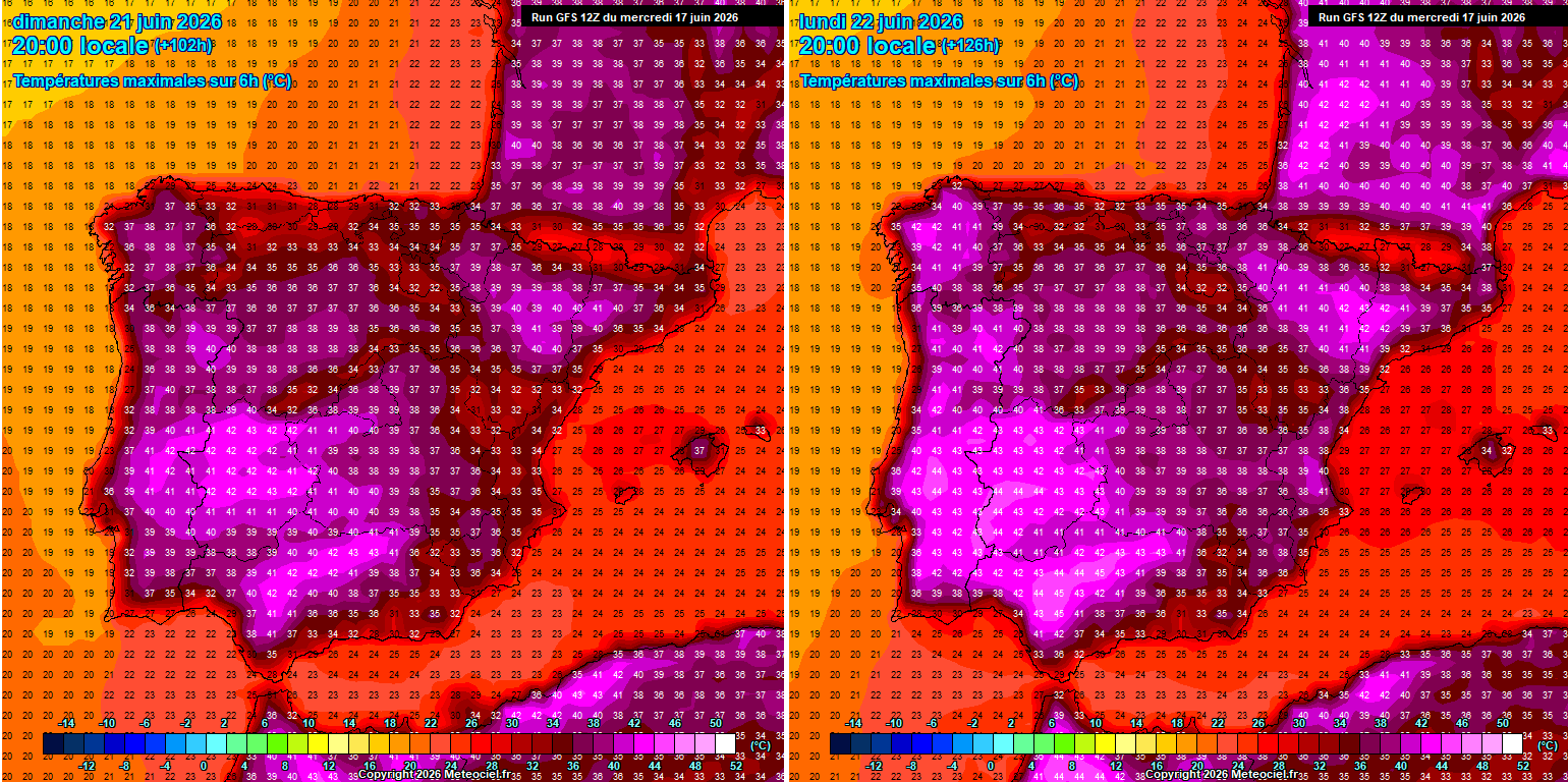
The significantly warmer air mass will gradually expand northward as we approach the weekend, with temperatures continuing to climb higher across southwestern Europe and spreading across much of western Europe by the weekend.
Until early next week, the warmest and most anomalous air masses will be over Spain, Portugal, France, Benelux, and the UK. Temperatures are forecast to gradually spread further north and east by early to mid-next week.
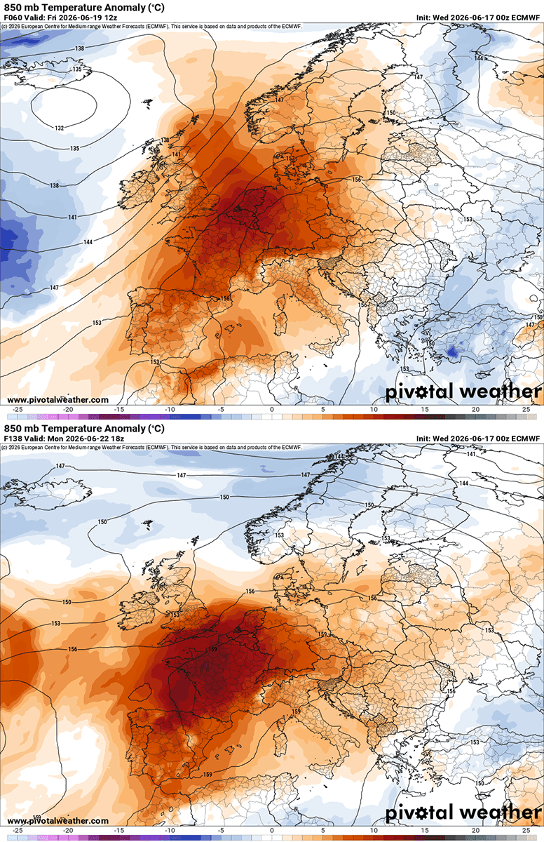
Near-surface temperature anomalies are already strong across Spain and Portugal mid-week, surging northward into France and the rest of western Europe in the coming days.
Temperatures will be into 14-18 °C above normals for late June, potentially even higher locally with the most anomalous air mass across western and central France.
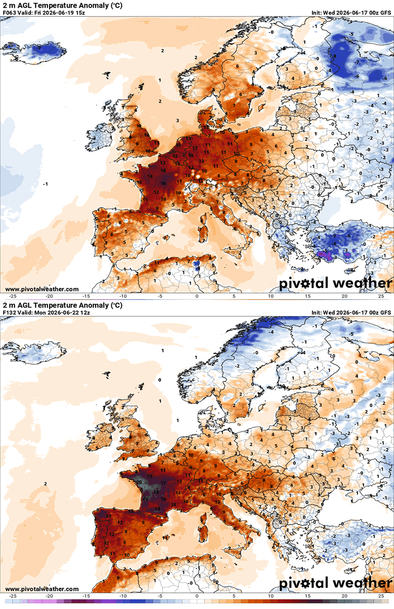
Therefore, daily highs will continue to reach the upper 30s and, in some regions, push into the low 40s by the end of the weekend.
The powerful heatwave expands north and will become long-lasting with temperatures above 40 °C in France and across Iberia
With the strengthening ridge aloft and an associated warm plume, temperatures have already climbed significantly across southwestern Europe. They are reaching the upper 30s across Portugal and Spain these days and will continue to rise into the weekend.
Scorching heat, locally up to 45 °C, is possible early next week.
The significant warmth and heatwave has already spread over France mid this week, with peak daytime temperatures reaching into the upper 30s in places. The hottest air mass is yet to arrive, with temperatures nearing the 40 °C mark on Thursday and much higher from Sunday through Monday next week.
Some weather models hint at brutal heat on Monday, with peak afternoon temperatures potentially reaching 41-44 °C across much of central, northern, western, and southwestern France. This could challenge some regional historic heat records for June.
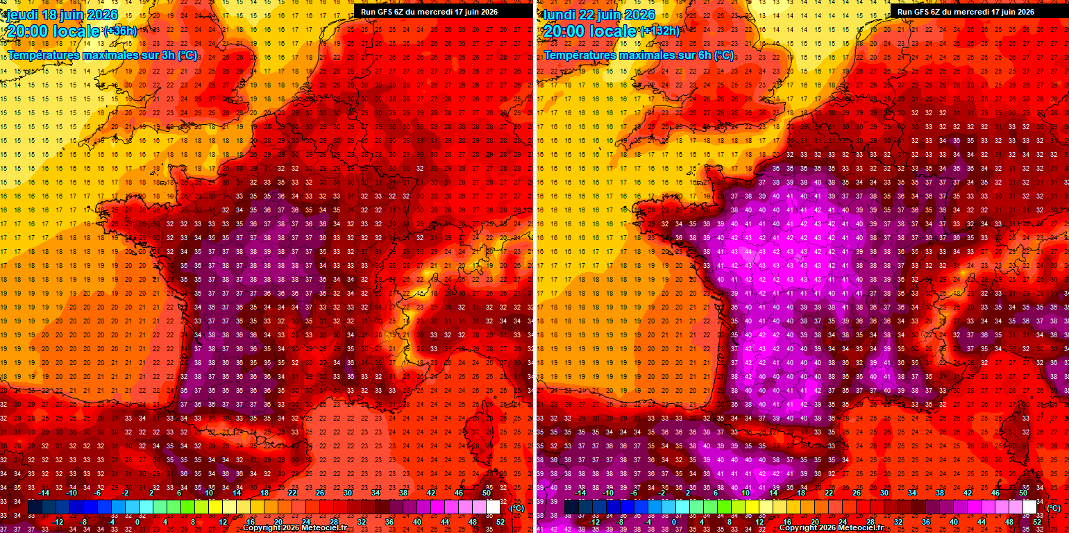
Warmth will also gradually expand into Germany and the Benelux as we head into the weekend, but it will not reach extreme temperatures next week, according to the latest guidance. This happens because the heat home remains parked over Western Europe, France, and the British Isles for a while.
The highest temperatures over western Germany and Benelux should reach low to mid-30s from Friday through Sunday.
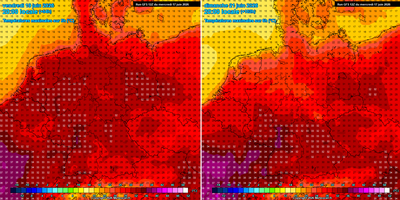
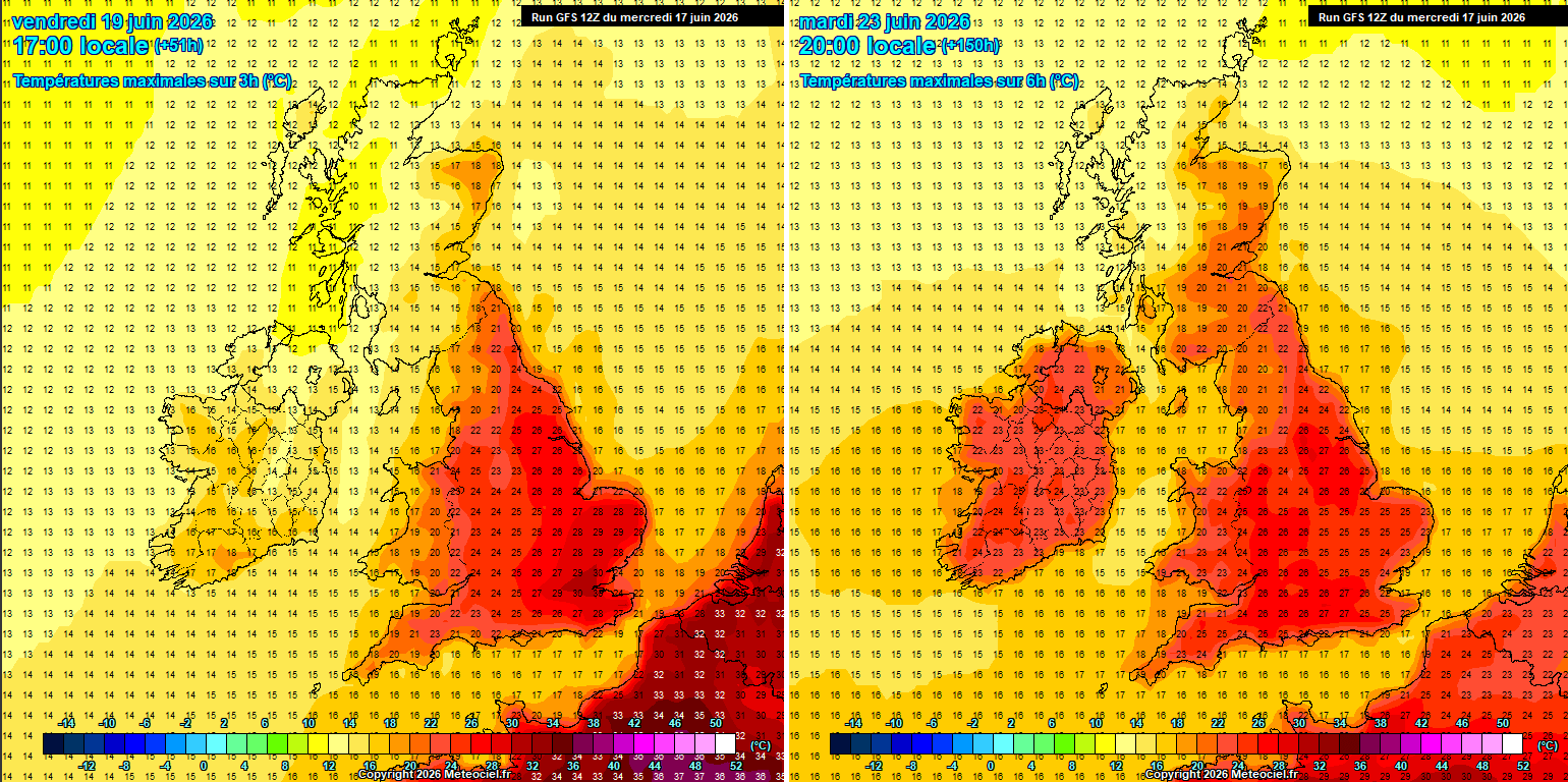
The British Isles will also experience much warmer days, possibly also into the low 30s on Friday and Saturday. For now, the highest temperature anomalies remain over France, so the UK and Ireland should avoid extreme heat. But things could change if the ridge expands further north next week.
Nonetheless, the coming days should allow near-surface temperatures to reach the upper 20s to low 30s across southern England on Friday, with the mid- to upper-20s elsewhere. Ireland will remain cooler until early next week, when temperatures warm into the mid-20s as well. Possibly higher, depending on the heat dome expansion and strength.
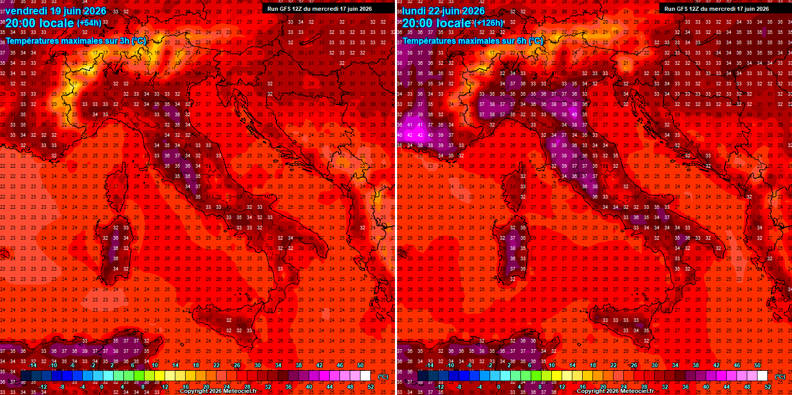
Temperatures will also gradually rise in central Europe and the Mediterranean over the weekend, with parts of Italy reaching the mid- to upper-30s. Monday and Tuesday next week could push peak afternoon temperatures into the 40s across the North Italian plains.
It will also become much hotter across the Balkans, but temperatures should remain in the low to mid-30s; they are not expected to get much higher due to the blocking ridge remaining further west, persisting over France.
However, the overall heatwave effect is likely to persist through the remainder of the month, so the accumulating heat will be long-lasting, worsening drought conditions and supporting wildfires. The soil is already quite dry in many areas.
We will be monitoring the ongoing development of the significant Heat Dome and will update the forecasts accordingly as the situation evolves next week. Stay tuned.
Stay tuned for the updates.
TropicalTidbits, Pivotal Weather, and Meteociel provided images used in this article.
See also:
NASA Detects a Major Pacific Sea Level Rise as Super El Niño Rapidly Strengthens