The festive Easter weekend brings turbulent weather for Ireland and the UK. An Atlantic Storm Dave undergoes rapid cyclogenesis on Saturday, tracking a path directly toward the northern British Isles.
The Met Éireann and the UK Met Office have issued severe weather warnings, placing much of Ireland, Scotland, and Northern England under significant weather alerts with the upcoming intense low pressure late Saturday into Easter Sunday. Storm Dave will bring multiple threats, violent winds, rain squalls, heavy snow, and high waves with coastal flooding.
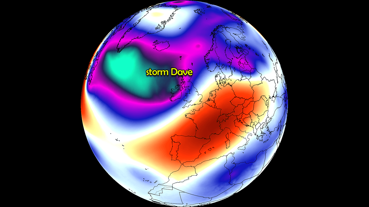
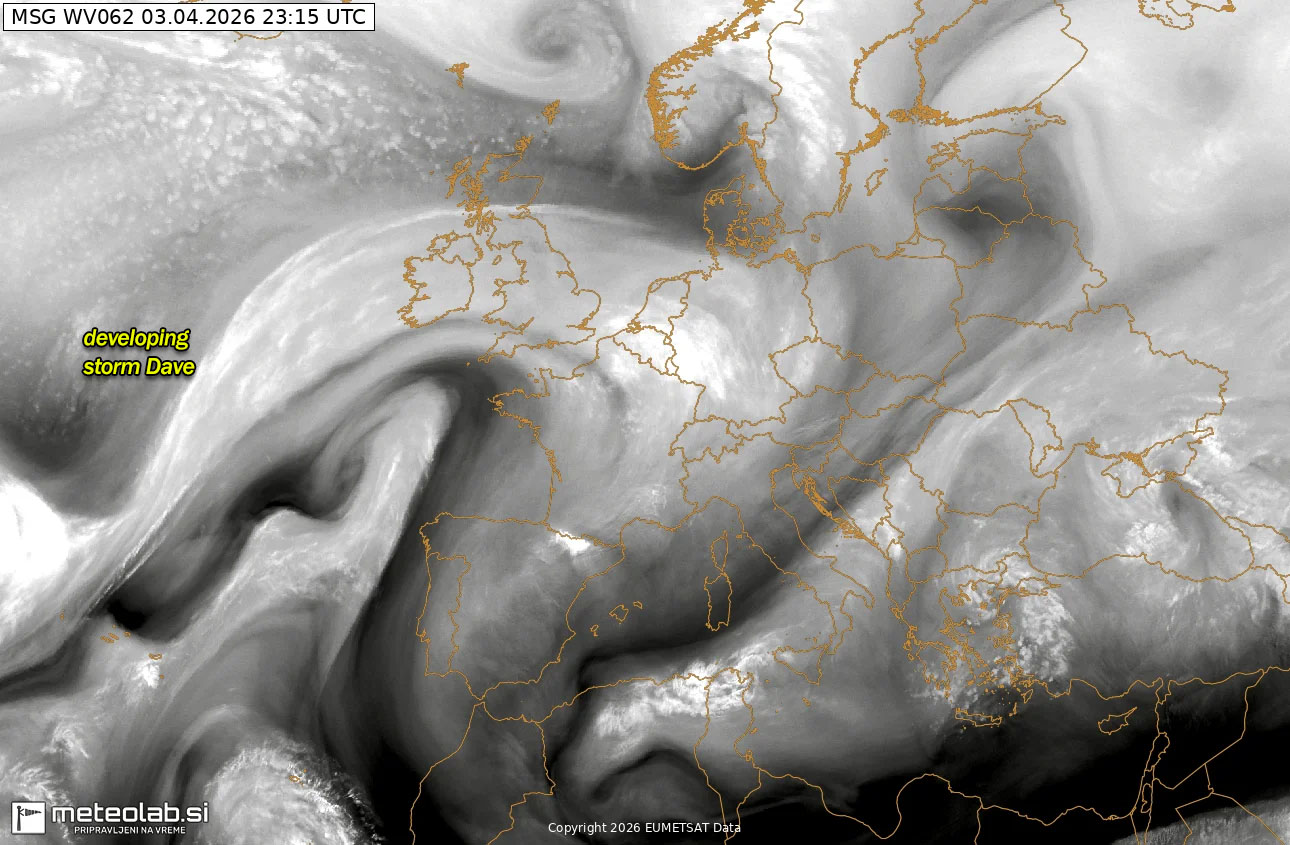
Storm Dave is already visible on the satellite images across the Atlantic and Western Europe, with a large circulation to the north of the Azores as of Friday night. Its path is due northeast into the British Isles late this Saturday.
While the primary concern will be damaging wind gusts reaching up to 90 mph, the Scottish Highlands will see up to 20-30 cm of fresh snow as the cold front moves through. For millions of Easter holiday travelers, the timing is quite unpleasant due to potential flying debris and significant delays across rail, ferry, and air networks.
With Dave’s center crossing the region through Saturday night and into Easter Sunday morning, the risk of coastal flooding remains high, with significant waves and coastal flooding threats.
On Easter Sunday, the system continues across the North Sea, maturing, and bottoms out its central pressure below 970 mbar before blasting into southwestern Scandinavia through Sunday morning. Violent coastal winds and deep snow are forecast for Western Norway.
Let’s dig into the details of Storm Dave for the Easter holiday weekend.
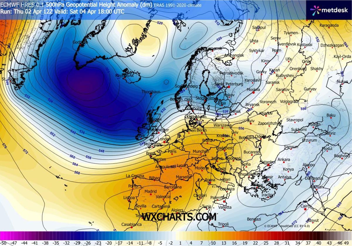
North Atlantic with active lows, a blocking ridge is developing over continental Europe
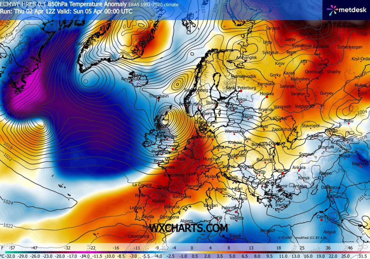
The general weather pattern over the North Atlantic and Europe reveals a classic active Atlantic and mild, stable weather over the continent as zonal flow establishes.
A deep Polar wave sits over the North Atlantic, introducing frontal systems and deep lows over the ocean, rapidly moving towards Western Europe. While a powerful upper-level ridge gradually expands into continental Europe and continues into the next week, spring is here for everyone.
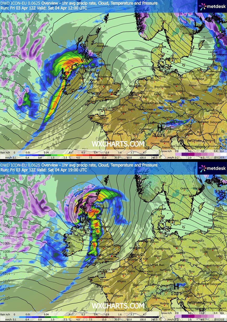
At the surface, a rapidly developing cyclogenesis will take place on Saturday, reaching Ireland and Northern Ireland by late morning and emerging into northern UK and Scotland by Saturday night.
By Sunday morning, the low reaches its peak intensity as it ejects into the North Sea before heading for the next powerful impact into Western Norway at midday.
The polar low drags a large mass of cold air that spreads over the North Atlantic, allowing it to remain active into the next week as well. While the returning zonal flow builds up the ridge over the continent.
This gradually pushes temperatures much higher, into the mid-20s for many countries in the coming days.
A powerful impact by Storm Dave late Saturday through Easter Sunday
The surface frontal analysis indicates that Storm Dave will first impact Ireland and Northern Ireland from Saturday morning into midday, with a well-developed core of intense precipitation and severe winds. The storm continues to rapidly intensify throughout the day.
By evening, the center of the low moves over Scotland, with a sharp frontal boundary extending south across the UK, and cold maritime air behind it spreading into Ireland and Northern Ireland. Heavy snow will develop over the Scottish Highlands.
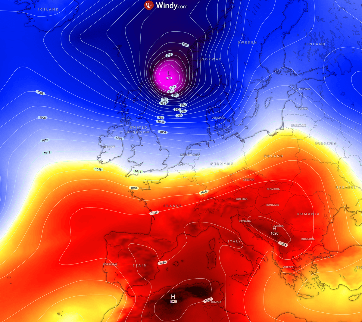
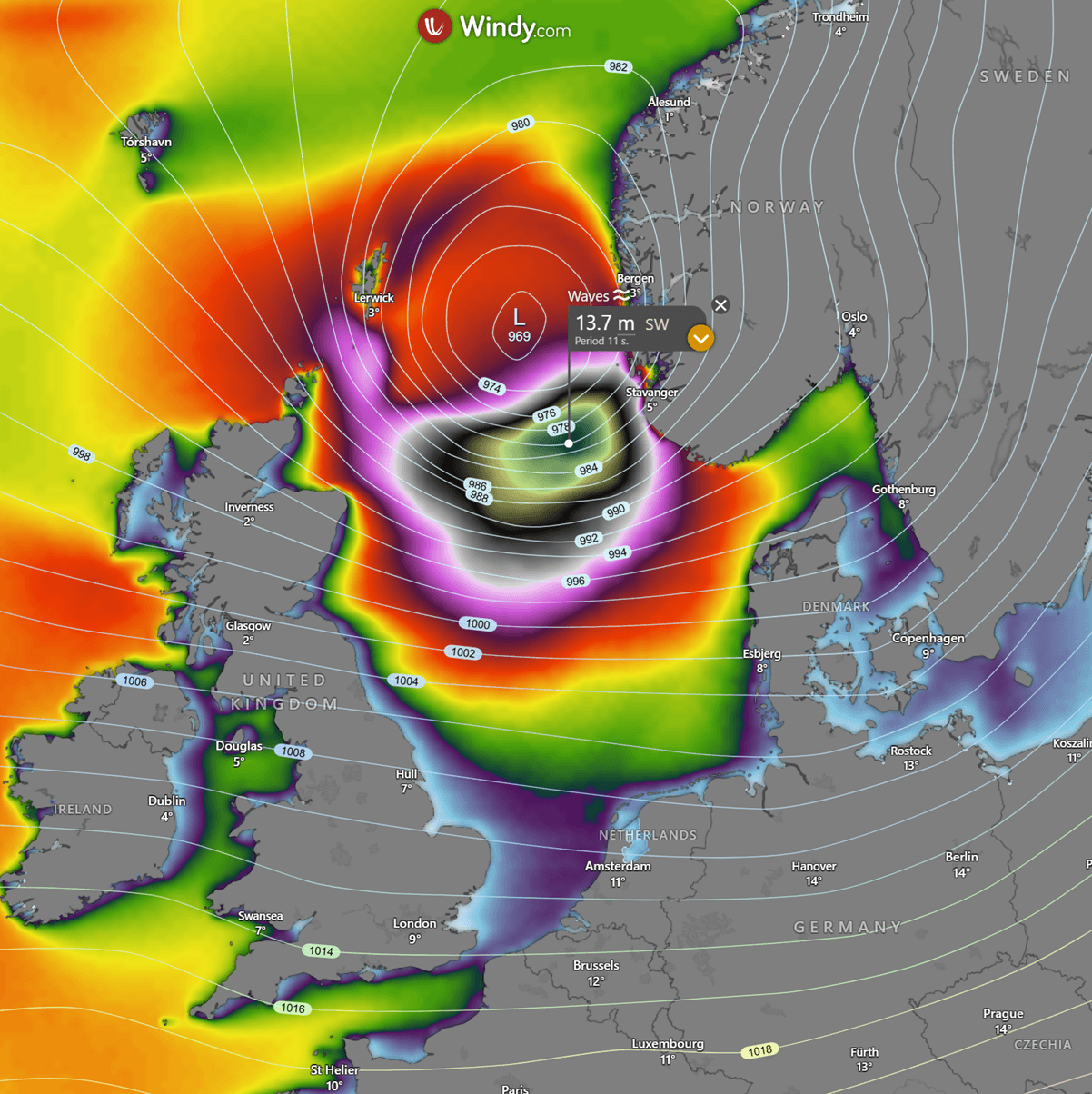
Going into Sunday, the low reaches its peak intensity over the North Sea, with the central pressure near 968 mbar. It further intensifies violent winds and generates high waves.
The attached chart reveals a swath of potentially severe, damaging winds along Dave’s path from Northern Ireland across Scotland and northern UK to the North Sea, reaching the coastal Western Norway by late Sunday morning.
The peak wind gusts are forecast to reach 140-170 km/h on the most exposed areas, possibly even higher over the Scottish Highlands through Saturday night. Blizzard conditions will be extreme there.
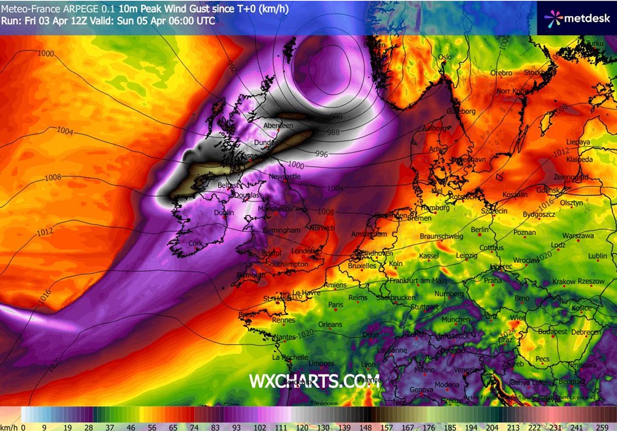
Another serious concern is the swath of potentially hurricane-force winds developing around the center of the low on Sunday morning, as Storm Dave peaks over the North Sea.
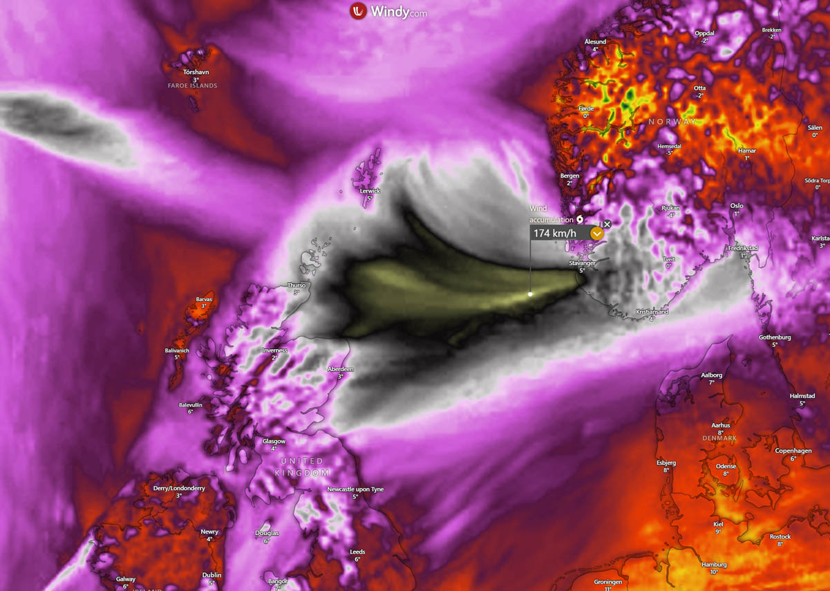
A narrow corridor with particularly intense wind gusts is forecast towards the coastal areas of Western Norway. The highest gusts could reach 170-180 km/h.
Thus, developing significant wave heights to the south of the core, gradually advancing towards the east.
The highest waves could reach up to 14 meters over the open North Sea before reaching the coast of Western Norway on Easter Sunday morning, with potential coastal flooding and destructive impact in the vicinity of Stavanger, Norway.
The overall rainfall amounts with the storm Dave are forecast to be relatively low over Ireland and the UK, especially as the low will be moving quite rapidly, and the main impact will be the violent winds. The highest amounts will be over the western Scottish Highlands, 40-60 mm by Sunday morning.
Due to the storm’s peak intensity over the North Sea on Sunday morning, precipitation in Western Norway will also be intense. Therefore, 60-100 mm will be possible in the region.
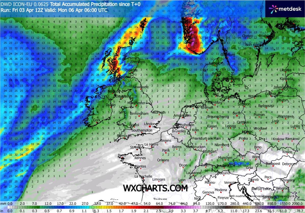
With potentially up to 50 cm of fresh snow in the higher terrain across the interior of Western Norway, posing extreme blizzard conditions as well.
Windy and Wxcharts provided images used in this article.
See also:
A Rare Spring Polar Vortex Core Extends Winter Weather Risks Into April