abcnews.go.com
The storm begins Friday afternoon with snow and ice in New Mexico and the Texas panhandle. By the evening, Dallas will see a wintry mix and Oklahoma City will see some snow.
Saturday is the most significant day for dangerous icing and heavy snow for the South.
On Saturday morning, the snow and ice will be stretching from Texas to Arkansas to Tennessee.
By Saturday afternoon, snow will be falling from St. Louis, to Indianapolis, to Cincinnati, to Charleston, West Virginia.
By Saturday evening, the snow and ice will cover a massive part of the country, stretching from New Mexico to the Carolinas.
Further south, a wintry mix or freezing rain will be hitting Dallas, Shreveport, Louisiana, Memphis, Tennessee, and Raleigh, North Carolina.
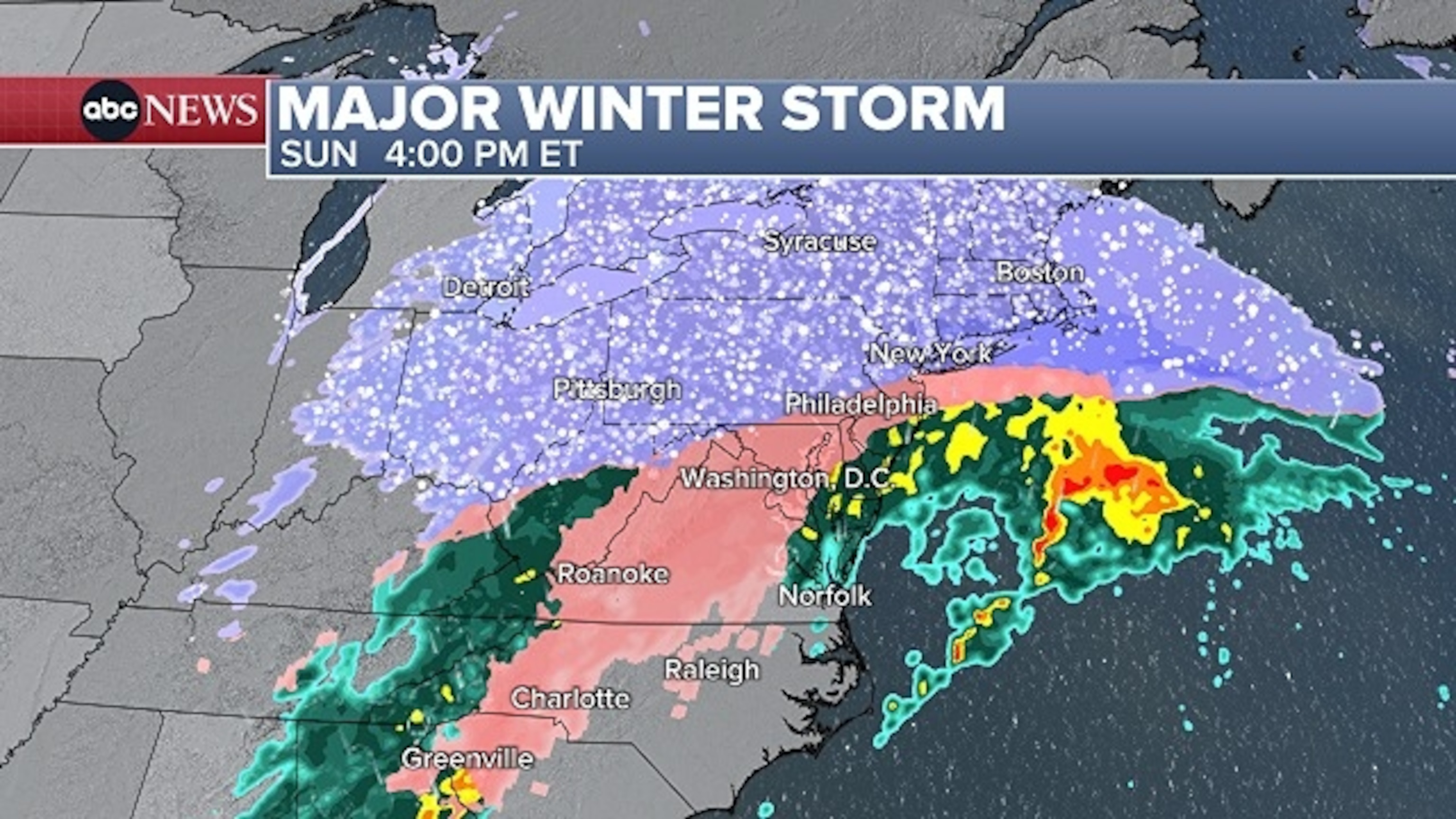
The storm will move east early Sunday, bringing snow from Wichita, Kansas, to Cincinnati, to Washington, D.C., to Philadelphia.
Freezing rain will be likely by sunrise in Houston, Memphis, Atlanta and Raleigh.
By noon, the snow will reach New York City, while the snow in D.C. will warm to a wintry mix.
It’s not yet clear which parts of the Interstate 95 corridor will get a wintry mix and which will get all snow on Sunday afternoon. But most of New England and the interior Northeast will see all snow on Sunday and early Monday.

A wide swath of plowable snow — 3 to 6 inches — is forecast from New Mexico through the Ohio Valley and up to Maine.
The heaviest snow is expected to be from the Texas panhandle to southern Missouri, as well as from the Ohio Valley to the Appalachian Mountains and New England.
In the Northeast, a large swath of the region could see over 1 foot of snow, with 6 to 12 inches forecast closer to the coast, from Virginia to southern New England coast. New York City’s latest forecast shows 8 to 12 inches.

Shoppers stock up on snow shovels ahead of a winter storm outside Strosniders Hardware Store in Bethesda, Maryland, Jan. 23, 2026.
Jim Lo Scalzo/EPA/Shutterstock
-ABC News’ Kyle David and Dan Peck


