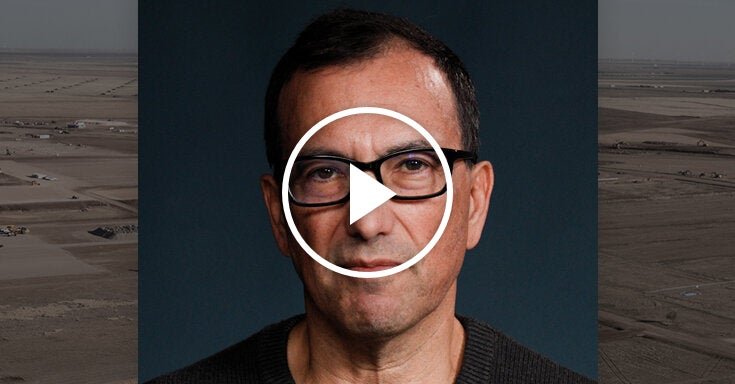

Ashley Moran clearly remembers the first time he completed the new four-day Gidjuum Gulganyi Walk in northern New South Wales, long before it opened to the public in April this year.
It was 2020 and the newest NSW Great Walk wasn’t even a track. “It had been pink-tagged by the trail construction company, but it was pretty arduous trying to navigate through dense rainforest and find those little pink ribbons,” he says.
Moran had been involved in developing the walk since its inception in 2018. As chair of the Widjabul Wia-bal Gurrumbil Aboriginal Corporation (WWGAC), he worked with the NSW National Parks and Wildlife Service (NPWS) and the Tweed Byron Local Aboriginal Land Council, which represents the Minjungbal clan of the Tweed Valley area within the Bundjalung nation.
As a proud Bundjalung man of the Widjabul Wia-bal clan, he also has a personal connection to the project: the southern half of the track runs through his people’s lands. (The Minjungbal people are the custodians of the northern part of the track.)
To minimise environmental damage, the Gidjuum Gulganyi (meaning “Old People’s track”) largely follows ancient walking trails that skirt the southern rim of the Tweed Caldera, created when the massive Wollumbin volcano, formerly Mount Warning, erupted 23m years ago. Only 19km of the 42km walk is completely new.
This makes the Gidjuum Gulganyi a rare window into a place that’s inseparable from the peoples who have inhabited and passed through it – with its warm temperate and subtropical rainforests, palm forests, waterfalls and wide open valleys – for tens of thousands of years.
It was Moran’s job, when he followed those little pink tags in 2020, to do some “ground truthing” on two proposed routes through Widjabul Wia-bal country. This involved checking that Aboriginal sites weren’t going to be negatively impacted by the trails created by NPWS, which was done in partnership with track builders from the local area and from Tasmania, considered among the best in the world.
Most of the Aboriginal sites found by the WWGAC weren’t on the trail itself, but some were close enough to warrant altering the route. “We had to ensure that people wouldn’t unknowingly stumble on to a significant site. So we haven’t publicised the locations of the recorded sites and we’ve made sure they’re a good distance off the track, to avoid any unexpected finds or disturbances.”
The experience gave Moran a better appreciation of Country. “[It] made me think about how the Old People would have used the trails, back when there was 75,000 hectares of rainforest up there.” Only 1% of this Big Scrub rainforest in the Byron hinterland remains, due to land clearing by European settlers; many of the original walking tracks crisscrossing this area were even repurposed as logging trails in the late 1800s.
“As far back as 22,000 years ago, these trails would have been heavily used by various clan groups within the Bundjalung nation,” Moran says. “People in the tableland areas would have used them to walk to the coast in summer for food resources. Elders would have used the trails to get to Wollumbin, a very important place [for them].
“Everyone would have watched for seasonal indicators in nature, like flowers blooming or migratory birds appearing, to tell them when and where they had to be to access food or perform certain ceremonies. All these rituals and movements happened over thousands of years and were embedded in our teachings and cultural practices.
“This trail is part of our traditional pathways, like the highways we have today, allowing people to travel through the landscape … If people were coming down the ridgelines to get to the coastline, they’d stop at certain spots to get food and water, to rejuvenate, camp the night, just like we stop at a Caltex to rest and refuel on a long trip,” he says.
after newsletter promotion
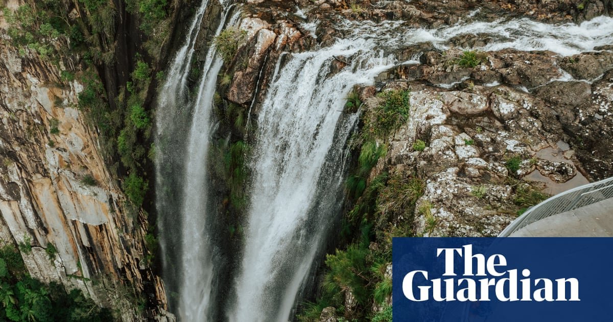
Three of those resting places on the Gidjuum Gulganyi are now campsites where hikers can pitch their tents on hardwood platforms amid towering eucalypts; the final campsite also has spectacular views across Wanganui Gorge.
The WWGAC was initially cautious about the impact of a multiday walk on their traditional lands, says Moran. “But the more we met with National Parks, the more our discussions became about developing business opportunities for our members and using this walk to promote our heritage.”
A new cultural tourism experience with Widjabul Wia-bal guides is now being developed at Minyon Falls, at the end of the walk, and is due to open by the end of 2026, he says. There are plans for Indigenous custodians to take over the maintenance of the trail, run cultural tours and businesses like coffee vans, and transport hikers to and from the track.
NPWS is also working with Widjabul Wia-bal native title holders and the Tweed Byron Local Aboriginal Land Council “to develop cultural interpretation signage that will allow Gidjuum Gulganyi hikers to learn about the cultural values of the Country they are immersed in during the four-day hike,” says a NPWS spokesperson. They expect this to be installed before June 2026.
“We want to ensure this isn’t just a tourist trail but an opportunity to learn about country,” Moran says. “To give people an appreciation of what this area means to the Widjabul Wia-bal people and the Minjungbal people in the Tweed area, which will in turn revitalise the walk, bring it back to life.”
In Moran’s favourite section of the walk, the trail emerges at the edge of a canyon with “the most beautiful scenery” looking north to the NSW-Queensland border. “That view blew me away the first time I did the walk, being able to look back at Wollumbin and across that Tweed Valley area. It just blew me away.”